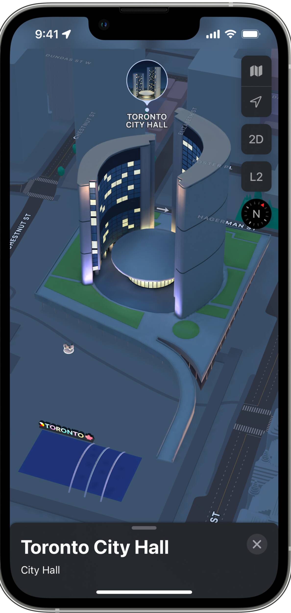
Apple Maps just launched a really cool 3D feature in Toronto
The CN Tower, City Hall and Toronto's many, many condos now appear in three dimensions with a new map feature from Apple.
The multinational technology company announced the new feature this week for three Canadian cities — Montreal, Toronto and Vancouver — along with a bunch of upgrades to their map app.
The three-dimensional city view comes with "rich detail" and includes enhanced navigation and "amazing details for road markings, land cover, trees, elevation, and public transit routes," Apple said in a press release.
"We're excited for Apple Maps users to explore the beauty and culture of Montreal, Toronto, and Vancouver in an incredibly detailed new way," said Eddy Cue, Apple’s senior vice president of Services.
Users can see elevation details across a city, new road details, and custom-designed landmarks such as Notre-Dame Basilica in Montreal, and Robson Square in Vancouver.
The 3D mode is accessed by tapping 3D in the side menu bar on an iPhone.

There is also a nighttime mode with a moonlit glow that activates at dusk. The 3D maps are also available in cities around the world, including London, Los Angeles, New York, Philadelphia, San Diego, San Francisco, and Washington, D.C.
Those looking for a bit more information can access city guides — including blogTO's guide for Toronto.
In addition to the map feature, there are more road details for drivers. Turn lanes, medians, bus and taxi lanes, and crosswalks are clearly displayed for navigating busy intersections.
There are also improvements for public transit riders with an updated transit map. Nearby stations are displayed at the top of the screen, and users can pin their favourite lines in Maps.
Once a transit route is selected, the map will automatically notify the user when they arrive at their destination. Riders can even keep track on Apple Watch.
For people with iOS 15, the Apple Map now has an augmented reality walking guide. Users can point their iPhone to scan buildings in the area, and Maps will deliver detailed walking directions that can be viewed in the context of the real world.
But this feature is only available in London, Los Angeles, New York, Philadelphia, San Diego, San Francisco Bay Area, and Washington, D.C., for now.
Karen Longwell
Latest Videos
Latest Videos
Join the conversation Load comments


