Snow expected to hit Toronto just in time for the first day of spring
Ah, March: In like a lion, out like a lamb, tons of wonky back-and-forth bullsh*t weather in between. That's just the way she goes in Toronto (and most of the northern hemisphere, I assume.)
Spring will make its formal calendar debut this Sunday, March 20, with the arrival of the vernal equinox. This marks the end of what's been a particularly cold and messy winter season, but not the end of cold and messy weather.
A "wintry mix" is on tap for much of Southern Ontario this weekend, according to meteorologists, following a brief but beautiful blast of warmth on Thursday and Friday.
Temperatures are expected to begin dropping a bit tonight, but should remain above seasonal as a Texas Low brings what the Weather Network describes as "our next bout of active weather" across the region.

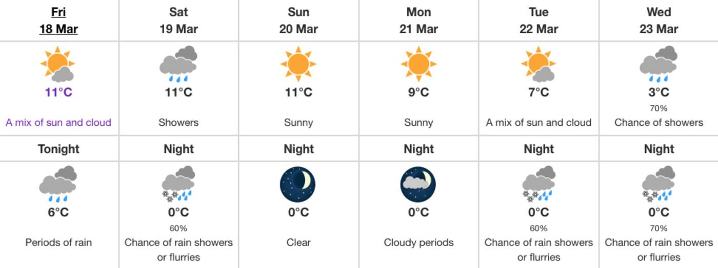
Image via Environment Canada.
"Precipitation will begin to push into southwestern Ontario and along the Lake Huron shores Friday evening, reaching the Greater Toronto Area (GTA) closer to the overnight period, spreading east into the rest of region Saturday," reads a report from the network published today.
"Cooler air filtering in behind the low will allow a wintry mix to develop over parts of southern Ontario Saturday overnight into Sunday morning as the system pulls away from the region."
Environment Canada's forecast shows a low of 0 C on Saturday night with a chance of flurries in the mix, but any snow we wake up to on Sunday morning will likely melt pretty quickly — a daytime high of 11 C is forecast for Sunday with nothing but sun in the sky.
It's looking like we could be seeing a more sustained period of messy weather next week between Wednesday and Friday, with both snow and rain in the forecast.
Stay strong, friends — it's almost over. That hot, humid Toronto summer weather we dream about all winter will be here soon... at which point we'll start longing for crisp winter air instead.
Latest Videos
Latest Videos
Join the conversation Load comments


