Toronto is a sloppy winter mess right now
If ever there were a day to market insulated galoshes, that day would be today.
Wildly fluctuating weather patterns have resulted in what can best be described as "gross" conditions on the ground this Wednesday morning in Toronto: Melting snow, slickened roads, pools of half-frozen water and salt clumps on sidewalks everywhere. Gross.
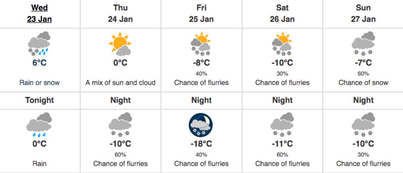
Temperatures have risen roughly 16 degrees over the past 24 hours, from -15 C to a comparatively balmy 1 C, albeit with snow and freezing rain in the mix. That garbage should become straight up rain (with strong and gusty winds, natch) as we reach a daytime high of 6 C later this afternoon.
Environment Canada blames the mess on a "Colorado low" tracking northeast across Lake Huron and Georgian Bay, bringing with it a warm front that will only serve to further melt some of the snow that's accumulated over the past few weeks.

Meteorologists are calling for plenty of precipitation amidst wildly swinging temperatures heading into the weekend. Image via Environment Canada.
"A brief thaw with rain and strong southwest winds gusting to 70 km/h are expected this afternoon into this evening," wrote the national weather agency in a special weather statement for the City of Toronto. "Colder air will return tonight."
Indeed, it will, freezing up all of that melted snow to make for "poor winter travelling conditions."
In other words, surfaces will be icy and slippery tonight, tomorrow, and presumably on Friday when temps drop off dramatically once again to a low of -18 C.
So watch your back (and front).
Latest Videos
Latest Videos
Join the conversation Load comments


