
What the Junction Triangle used to look like
In neighbourhood terms, the Junction Triangle is a relatively new creation. Historically, the wedge-shaped area bound by rail tracks on all sides to the east of the Junction was a place where heavy industry nudged up against residential streets.
Factories making everything from aluminium auto parts and home appliance parts to chocolate bars lined the streets close to the Canadian Pacific rail tracks with brick homes and crowd-filled playgrounds a short walk away.
Today, the neighbourhood is undergoing rapid gentrification. The remaining industrial sites are being converted into residential units and homes on Wallace, Perth, Symington, and Campbell avenues are selling for seven-figures.
This is what the Junction Triangle used to look like.
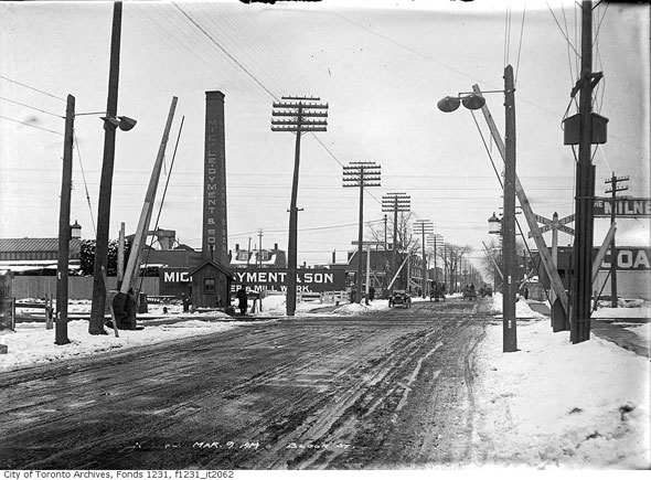
Bloor St. looking east towards Perth Ave. on March 9, 1914.
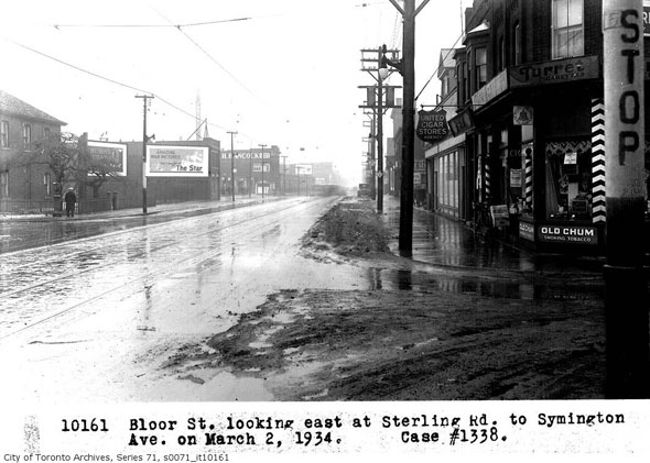
A wet and muddy Bloor St. at the corner of Sterling Rd., looking east, in March 1934.
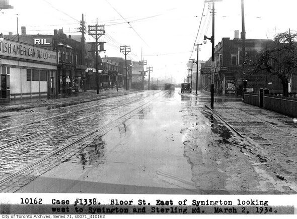
Bloor St. west to the railway underpass in March 1934.
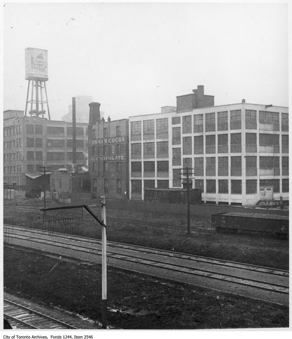
Cowan's Cocoa and Chocolate factory on Sterling Rd. in 1922. Founded by John Warren Cowan, the company produced and sold tea, coffee, and candy, such as "Iceland Moss Cocoa" and "Queen's Dessert Chocolate." The business was sold to British company Rowntree and Company (Canada) Limited in 1926.
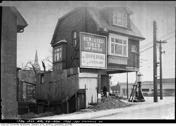
A house converted for use as a gas station at Dundas and College streets in April 1939.
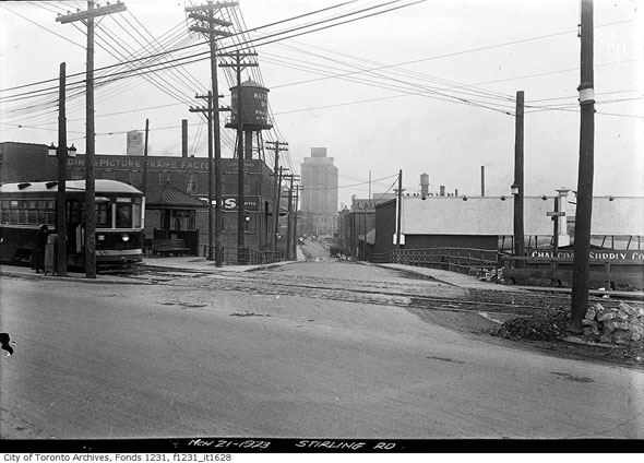
North from Dundas St. along Sterling Rd., March 1923. The Northern Aluminium Company Building is on the horizon.
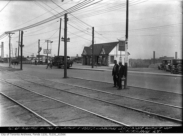
Dundas St. southeast from Sterling Rd. in June 1937.
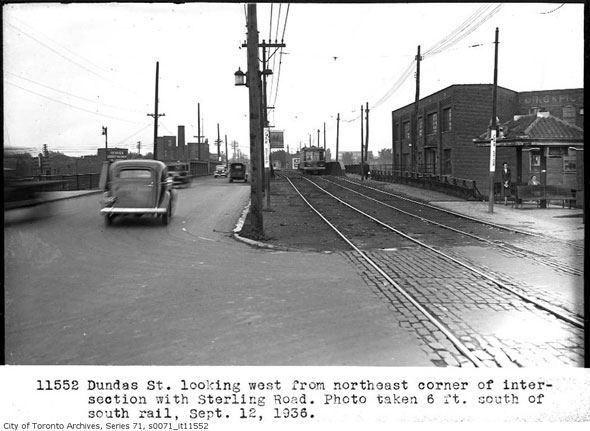
Looking west from Dundas St. and Sterling Rd. Note the separated the vehicle and streetcar tracks on the railway overpass.
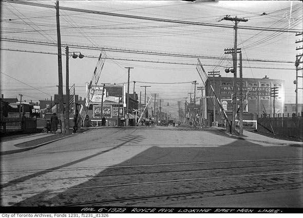
At-grade railway crossing at Dupont and Dundas streets before construction of the railway overpass in 1923.
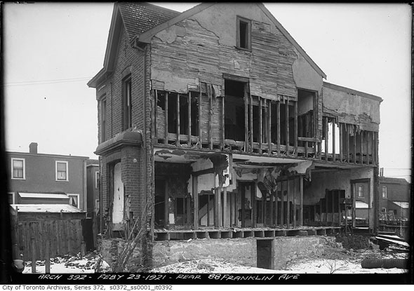
A wrecked house on Franklin Ave. in 1921.
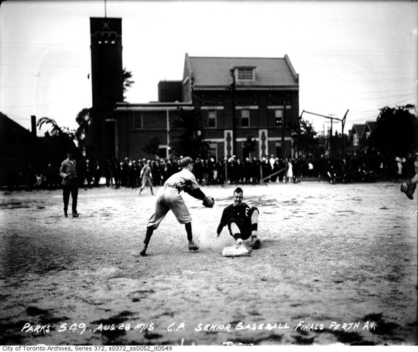
Opening day of the a senior baseball tournament on the Perth Ave. playground in May 1915.
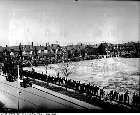
A crowd gathered to watch a baseball game at the Perth Ave. playground in 1920.
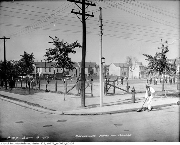
Street sweeper cleans near the Perth Ave. park in 1913.
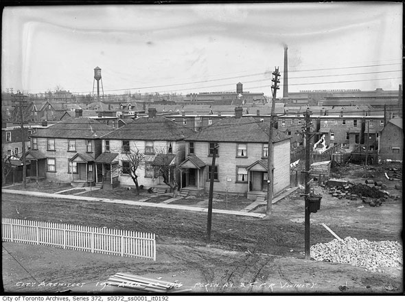
View of Perth Ave. from the roof of a building near the CP tracks in 1916.
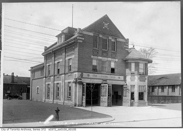
Perth Ave. fire hall, just south of Dupont, on May 9, 1914. The building opened in 1910 and was demolished in the 1960s.
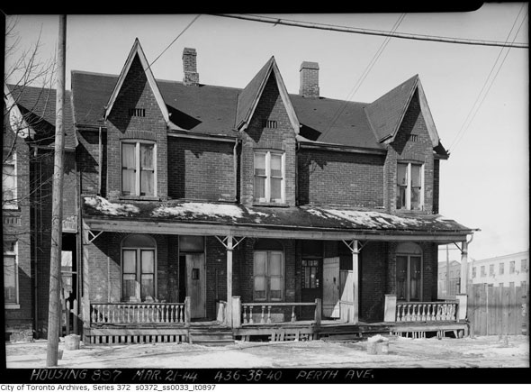
436-440 Perth Ave. in 1944. Two of these homes are still standing. The one on the far right of the picture has been demolished and replaced by a laneway entrance.
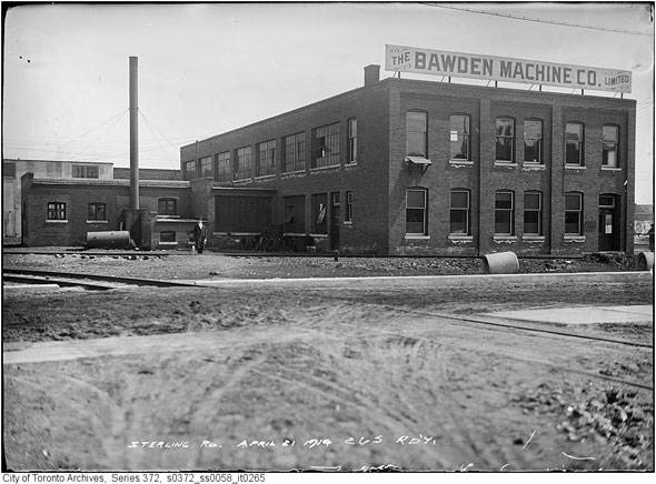
The Bawden Machine Co. factory in April 1914. The company, which made water pumps and fire hydrants, was founded roughly 10 years before this photo was taken.
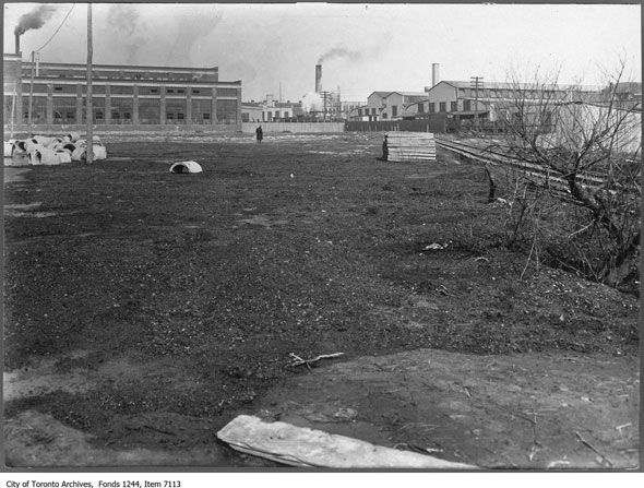
A charcoal pool near Sterling Rd. in 1911.
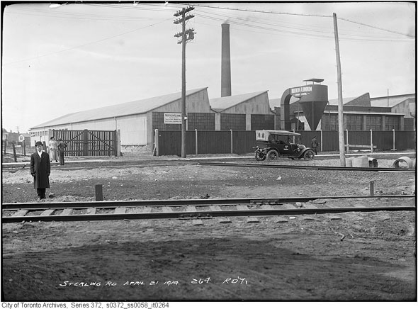
An unidentified industrial site near the rear of the Bawden Machine Co. plant. in 1914.
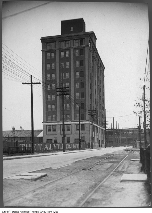
The 12-storey Northern Aluminium Company Building on Sterling Rd. Built in 1920, the tower was part of a complex that produced cooking utensils and military supplies during both world wars. Later, engine parts, bottle caps, and home appliances accessories were also made there. The Toronto heritage building is currently being converted for residential use.
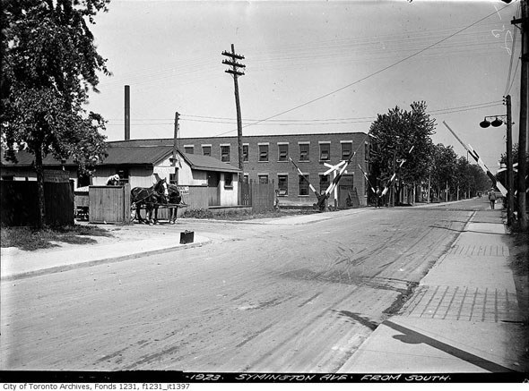
Railway crossing on Symington--now replaced with an underpass--in 1923.
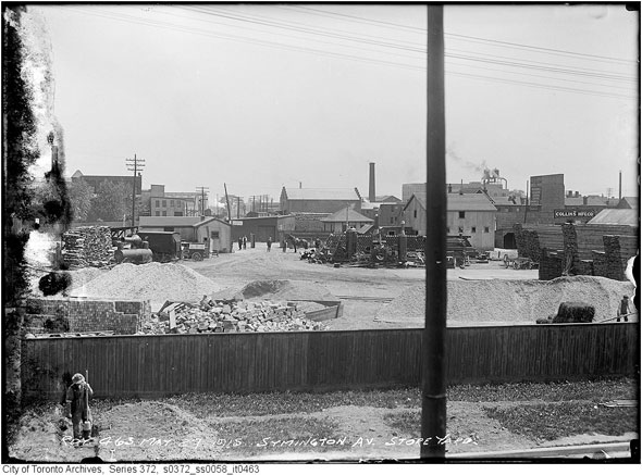
Storage yard on Symington Ave., May 1915.
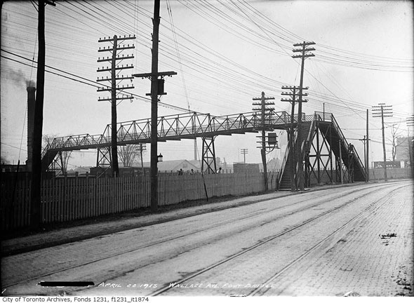
The historic Wallace Ave. bridge over the rail tracks in April 1915.
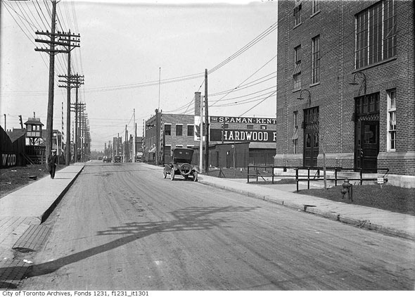
West on Wallace Ave. in 1923. Both the brick industrial buildings on the right side of the photo are still standing. The one in the foreground is home to artist studios and video games company Ubisoft, among others.
Chris Bateman is a staff writer at blogTO. Follow him on Twitter at @chrisbateman.
Images: City of Toronto Archives
Latest Videos
Latest Videos
Join the conversation Load comments


