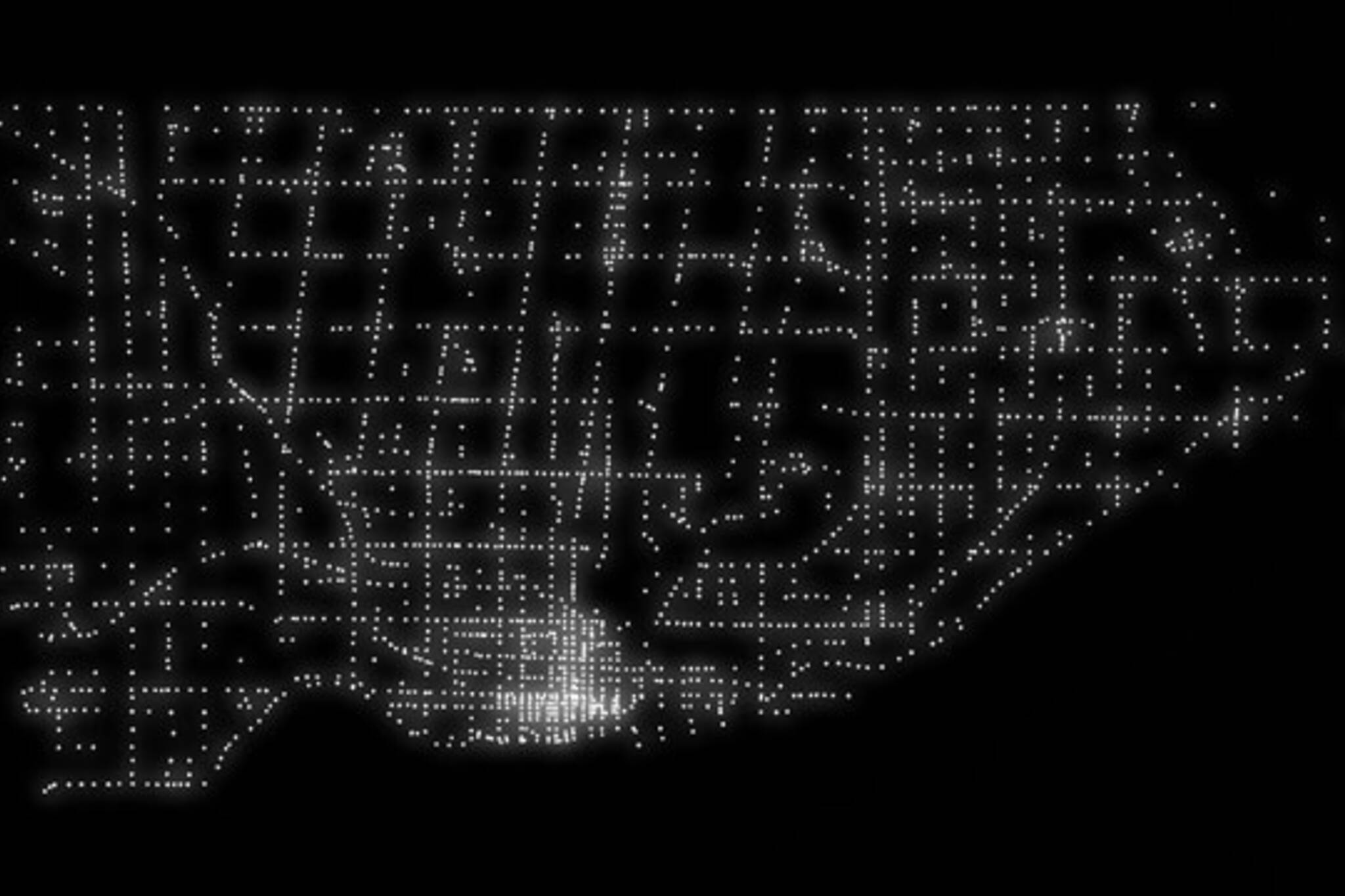
A map of every traffic signal in Toronto
This beautiful image of Toronto might look like an album cover for an 80s synthpop band, but it's actually a visual representation of every traffic light-controlled intersection in the city. A pinpoint of light for every set of lights.
The image (full-size version here) was created using information from the city's open data portal by William Davis, a Reddit user. Late last year Davis used city data to track infilling along the downtown waterfront.
The first traffic signals in Toronto were installed at Yonge and Bloor in 1924. There are now some 2,300 individual traffic signals, some timed, some controlled by a sensor embedded in the road, across the city. As the map illustrates, downtown is the most signal-dense part of the road network.
What's really amazing is that Toronto, zoomed out and reduced to a collection of dots, is still easily recognizable. The negative space created by the Don and Rouge river valleys is also visible, if you look carefully, so are winding Weston Road and Dundas Street.
See what else you can spot.
Chris Bateman is a staff writer at blogTO. Follow him on Twitter at @chrisbateman.
Latest Videos
Latest Videos
Join the conversation Load comments


