Toronto braces for its third straight weekend of snowy weather woes
Another Friday is drawing near for the people of Toronto, but so too is another potentially-messy, late winter weather system that threatens yet another big dump of snow just in time for the weekend (and March Break.)
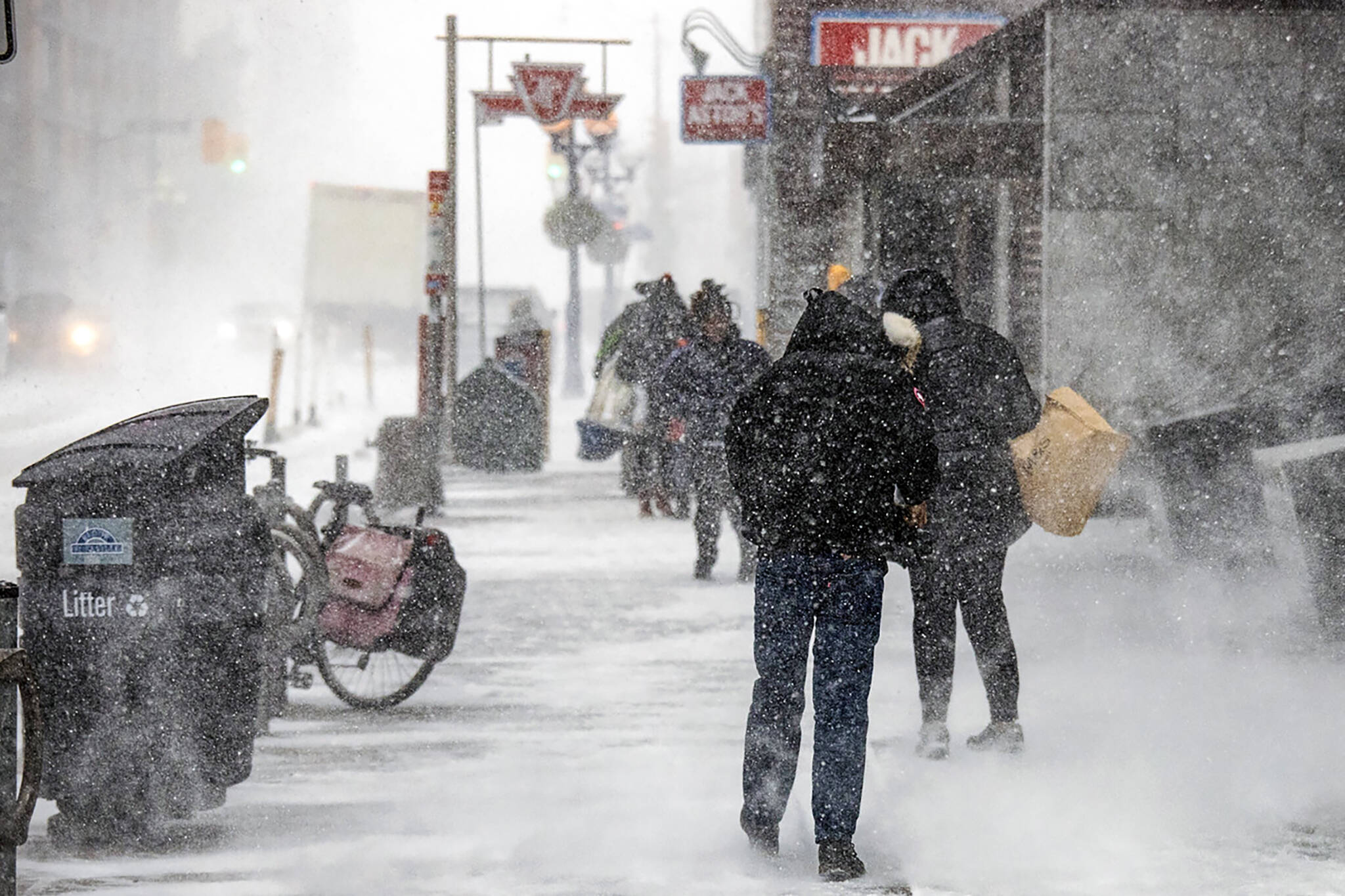
"A fledgling Colorado low moving toward the Great Lakes to end the week will follow a similar track to last week's storm, but on a smaller and weaker scale," writes The Weather Network, referring to blizzard-like conditions that swept through southern Ontario last Friday night.
Weather Network meteorologist Dr. Doug Gillham reports that up to 15 cm of snow is expected in Hamilton, Niagara, and much of southern Ontario.
Environment Canada has already issued special weather statements for the aforementioned regions ahead of Friday's storm, as well as for Windsor, Essex, Chatham-Kent, Simcoe, Delhi, Norfolk, Sarnia-Lambton, Oxford-Brant, London-Middlesex, Elgin, Dunnville, Caledonia and Haldimand.
⚠️ A special weather statement remains in effect for parts of southern Ontario
— ECCC Weather Ontario (@ECCCWeatherON) March 9, 2023
❄️ 10-15 cm of snow Friday morning into the night
⚡ No thundersnow expected this time 😔
Watch for updates to alerts 👉 https://t.co/Tyr89TZ6E8#ONStorm #ONwx pic.twitter.com/Qmbzrhn9oX
"Total accumulations of 10 to 15 cm possible. Visibility may be reduced at times in snow. Surfaces such as highways, roads, walkways and parking lots may become icy and slippery," reads the weather alert in effect for Hamilton as of early Thursday afternoon.
"Snow will begin early Friday morning over extreme southwestern Ontario and reach the Niagara region Friday afternoon. Snow will end from west to east Friday night."
The federal weather agency warns that Friday evening's commute will likely be impacted by adverse weather conditions, which may throw a wrench in March Break travel plans for some GTA residents.
Lower snowfall totals are expected within the City of Toronto itself, with a maximum of 10 cm predicted by Friday night. This is subject to change, however, based on the strength and direction of the incoming system when it hits southern Ontario this evening or early tomorrow morning.
It's not over yet...#Toronto #TorontoWeather https://t.co/59soqyxNNv
— Sheppard Centre (@sheppardcentre1) March 7, 2023
Anyone who'd rather ski or snowboard than go down south this March Break will be pleased to note that "colder than normal temperatures will dominate next week" in the GTA, and that even more snow is in the forecast for Monday.
"With snow banks standing high and clean-up still ongoing from a couple of major snowstorms over the last two weeks, any snow in the forecast may have some Ontarians feeling uneasy — especially for those with travel plans as many kick off March break," reads a Weather Network update published Thursday.
"The next snow system to hit the region arrives Friday, so travellers are urged to pay close attention to the forecast, as a minor shift in the storm track could have an impact on ultimate snowfall totals."
Latest Videos
Latest Videos
Join the conversation Load comments


