This is how Toronto's massive 16 km linear park will look when it's finished
The 16 kilometre park that will eventually run all the way from the Don River ravine to Rouge National Urban Park is a few steps closer to being complete, and these renderings and visuals give a sneak peek into what it'll look like. 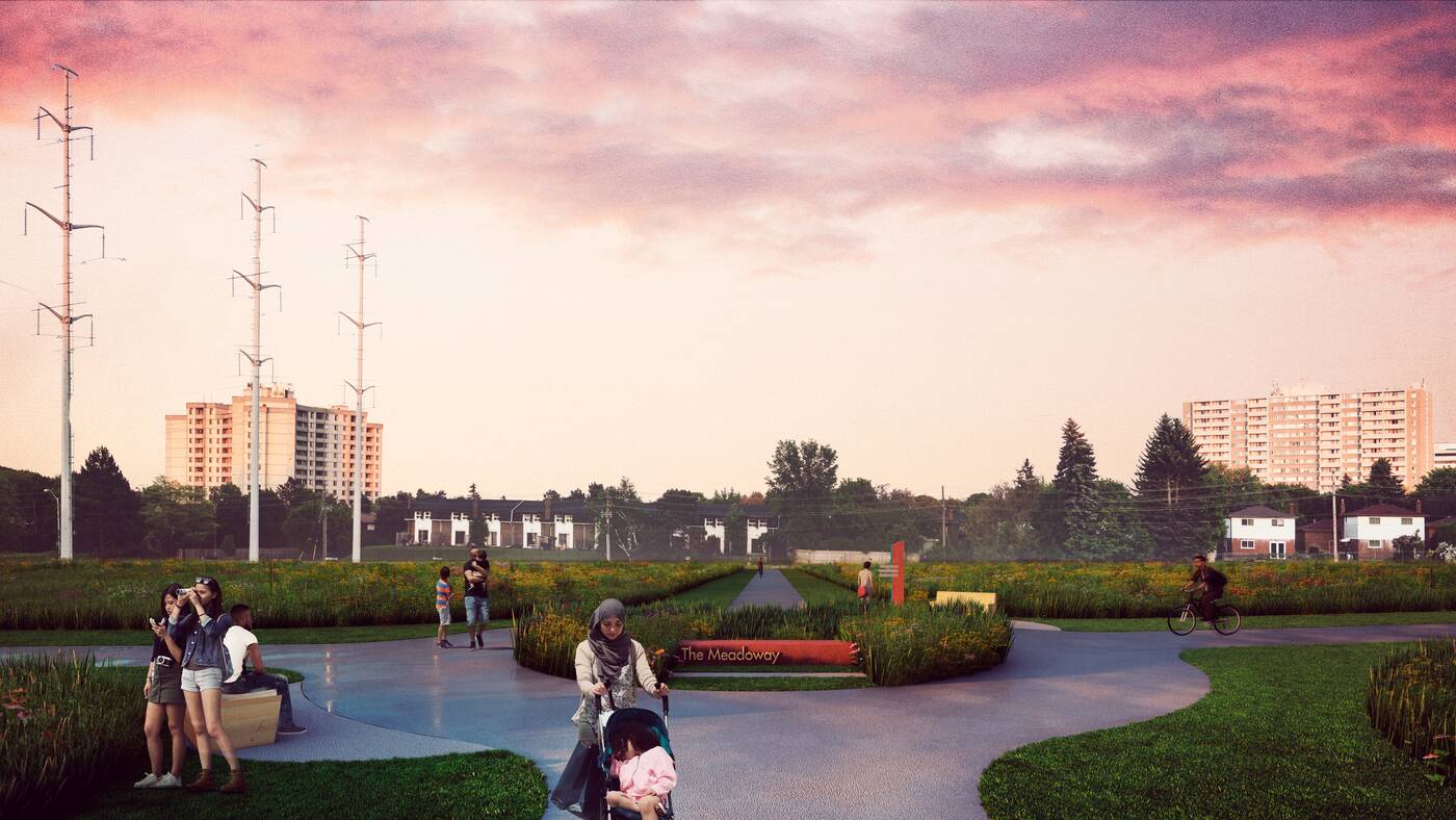
Rendering of a trail intersection in The Meadoway.
The Toronto Region Conservation Authority (TRCA) has been working with the City of Toronto to transform the once barren (save for the power lines) Gatineau Hydro Corridor in Scarborough into a lush meadowland to be known as The Meadoway.
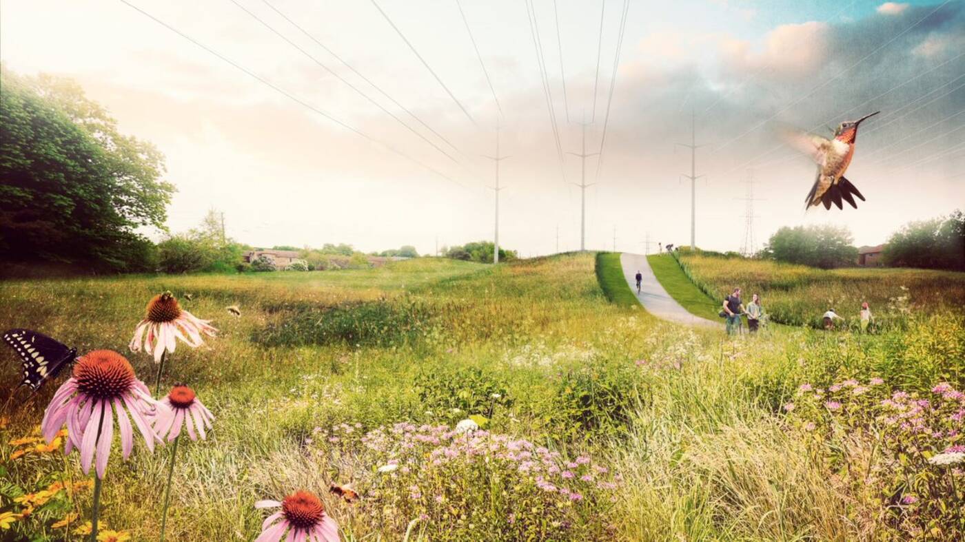
Rendering of the multi-use trail surrounded by meadows.
Once finished, it'll be a fully connected multi-use trail for biking, walking and jogging complete with trail intersections and road crossings.
It will be the largest linear urban park in Canada. 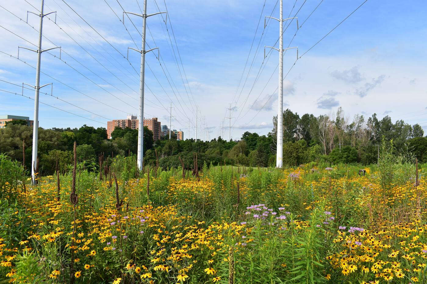
Photo of the vibrant meadows that are already growing in the area.
Since they broke ground in 2018, the section extending from Brimley Road to Scarborough Golf Club Road has been completed, and now features 3.5 kilometres of continuous trail.
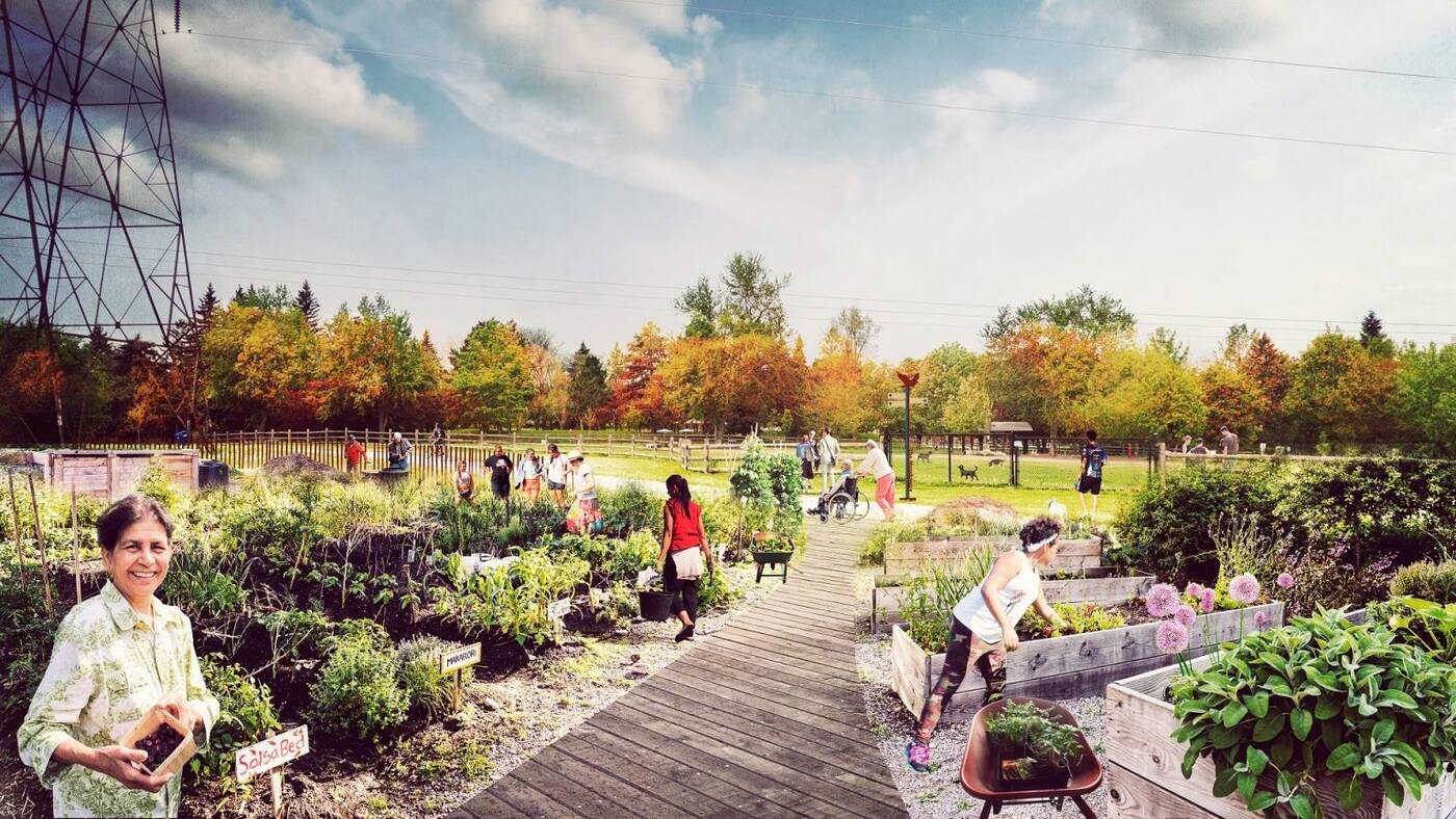
Rendering of the urban agriculture and gardens that will cover a previously empty area.
About 67 hectares, so half of the entire park, has also been seeded with native meadow plant species since the fall of 2020. It's now filled with wildflowers, butterflies and birds.
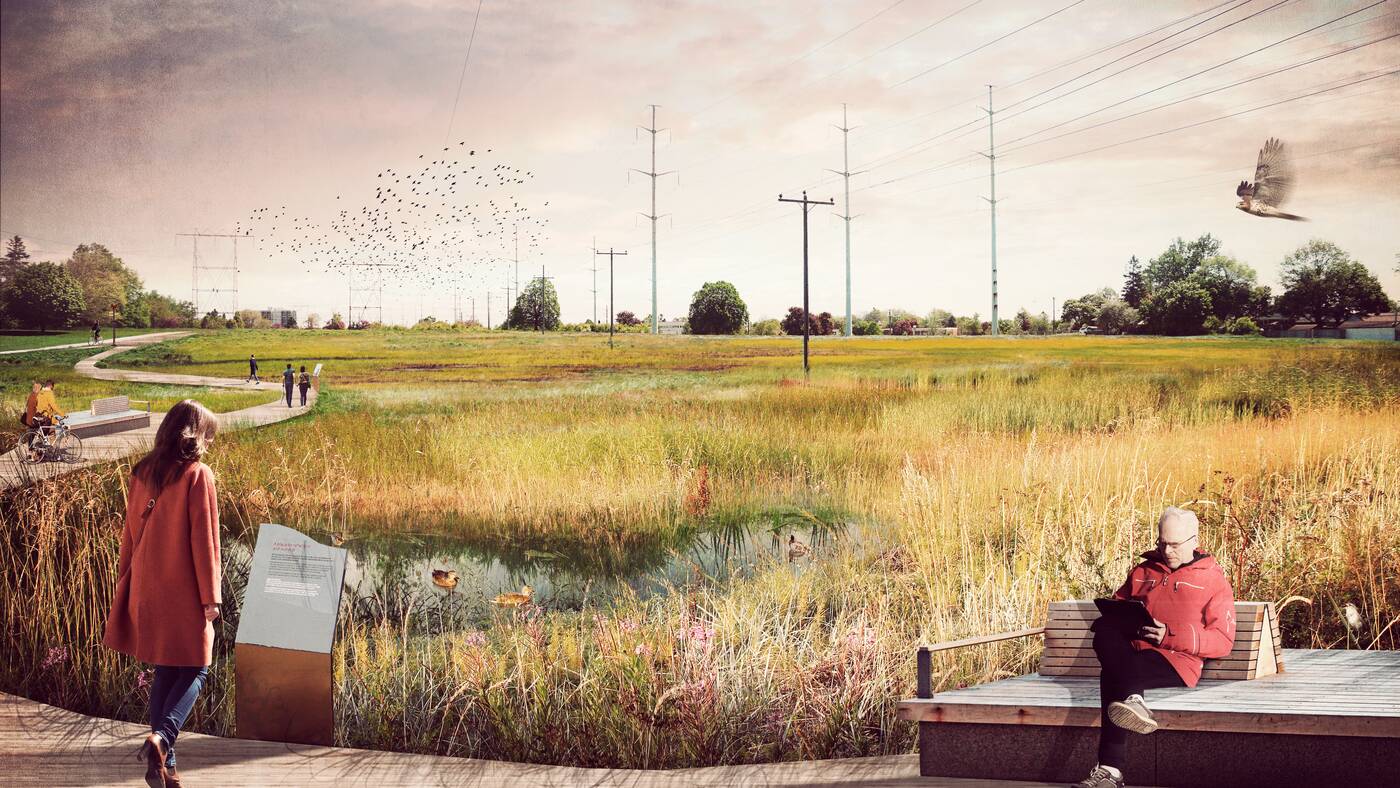
Rendering of wetland and informational plaques that will soon be at the Meadoway.
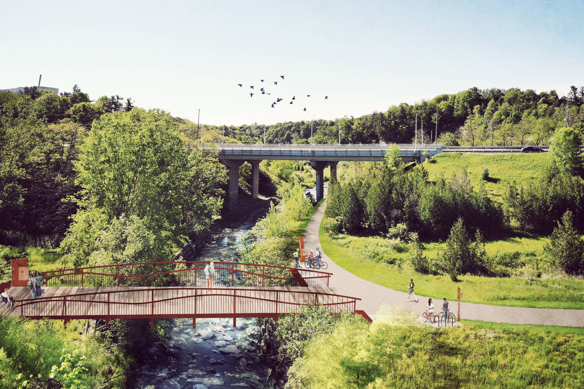
They've also just started at Highland Creek on the section extending from Scarborough Golf Club Road to Neilson Road, which is said to be completed by the end of 2022. This will include a large pedestrian bridge to connect The Meadoway with the other trail in the area.
The remaining gaps in the trail network, including the area extending from Kennedy Road to Brimley Road and from Neilson Road to Conlins Road, are still being designed.
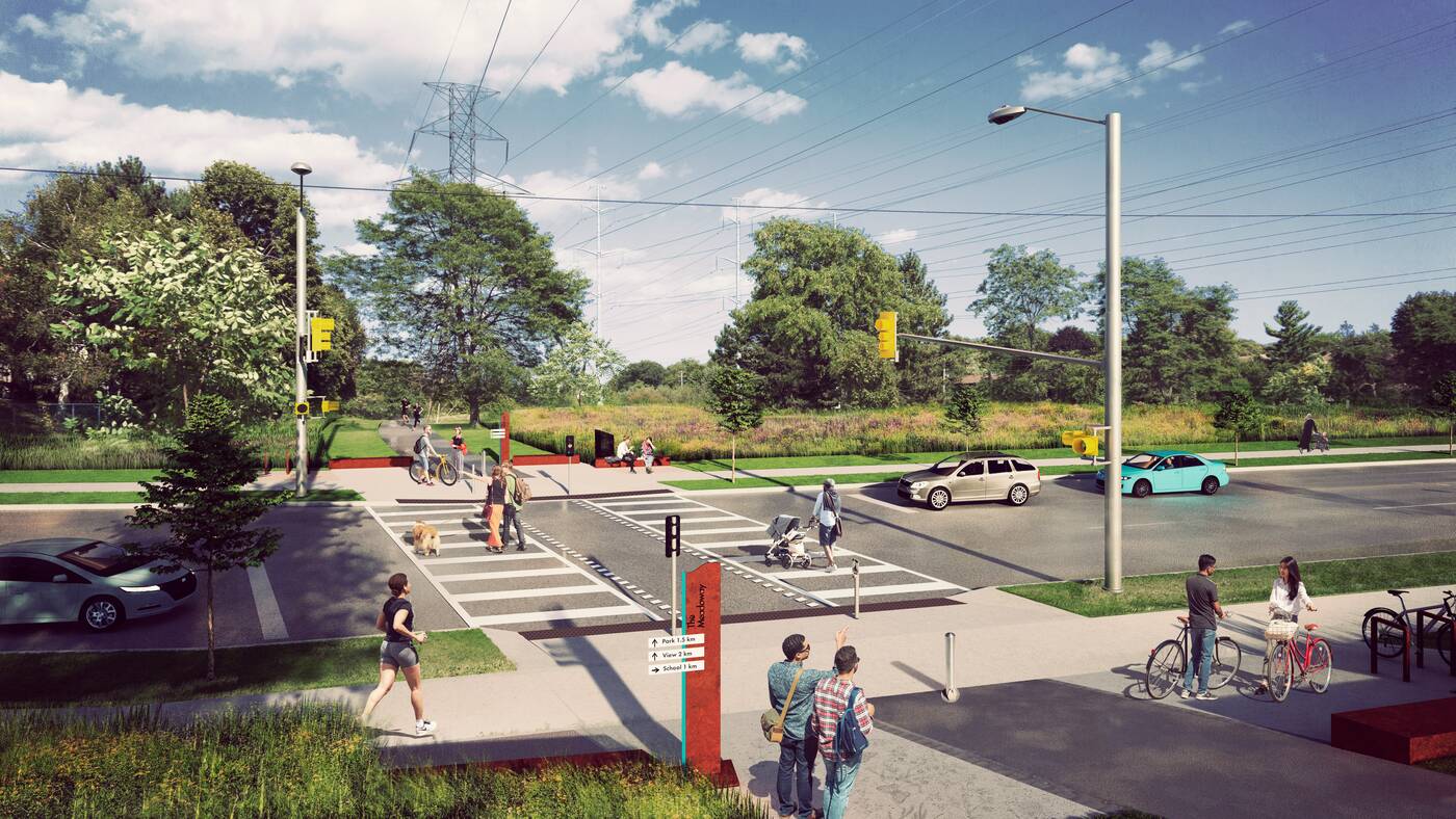
Rendering of the road crossing at Neilson Road.
The entire $40-million project that will eventually connect four different ravines, 15 parks, 34 neighbourhoods, over 500 acres of land and more than 1,000 diverse species of flora and fauna is on track to be completed by the end of 2024.
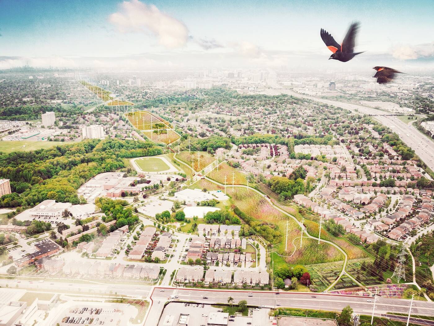
Rendering of a bird-eye view of the eastern entrance.
Although we'll still have to wait a little longer for the final product, there's no reason we can't visit a portion of it this winter before the meadows start to bloom.
Toronto and Region Conservation Authority (TRCA), Future Landscapes and Perkins & Will
Latest Videos
Latest Videos
Join the conversation Load comments


