
What Queen Street used to look like in the 1980s
Until now, the Toronto of the 1980s fell into something of a blind spot among the City of Toronto Archives' digital offerings. Street photos that had been digitized tended to stop in the 1950s and 60s, leaving a tantalizing multi-decade gap to the present day. But now, thanks to a recent dump of photographs from the late 1970s and early '80s, it's possible to fill in some of the blanks and recall a city that is at once familiar and alien (I mean, where is everybody?)
The early 1980s were a time of transition for streetcars and transit in general in Toronto. The old Presidents' Conference Committee streetcars (above) were gradually being replaced by the incoming CLRVs. Trolley buses - electric vehicles that drew power from overhead wires - were entering their final decade on the streets of the city. All three are visible in these photos, which are arranged in order from Queen and Roncesvalles in the west to Queen and Leslie in the east.
Spot anything interesting? Leave a comment.
See also:
- What Queen Street East used to look like in Toronto
- What Queen West used to look like in Toronto
- Behind the scenes at Lower Queen Station
Lead photo: Queen and Yonge outside Simpsons. August 31, 1983.
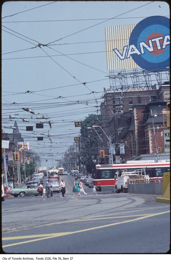
Queen and Roncesvalles, July 18, 1983.
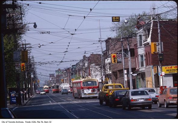
Two types of streetcar and a trolley bus on Queen just west of Shaw, July 13, 1983.
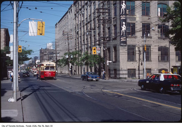
Queen and Shaw, looking east, June 6, 1981.
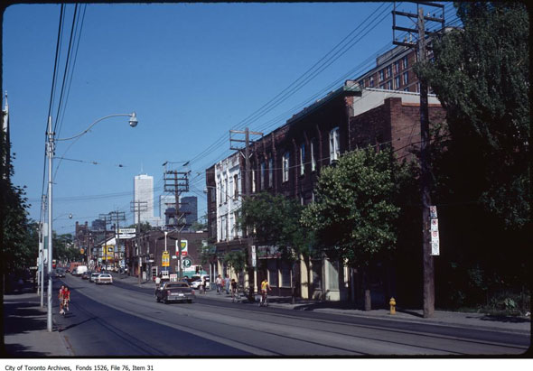
Queen and Gore Vale, July 13, 1983.
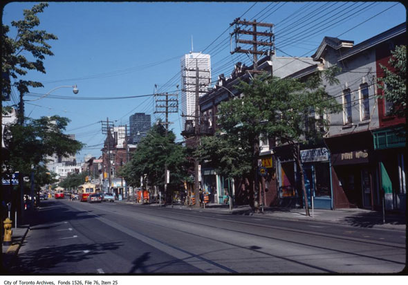
Queen and Bathurst, looking east, July 13, 1983.
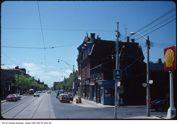
Queen and Beverley, looking west, June 7, 1981.
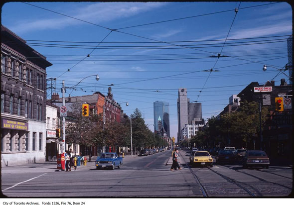
Dead quiet Queen and Spadina in late summer. September 27, 1981.
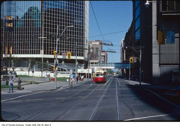
Queen and Bay, June 7, 1981.
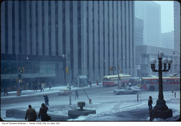
A harsh and modern-looking Queen and Bay during a snowstorm. March 13, 1980.
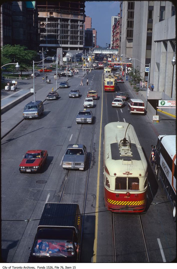
Overhead view of Queen near City Hall, July 8, 1980
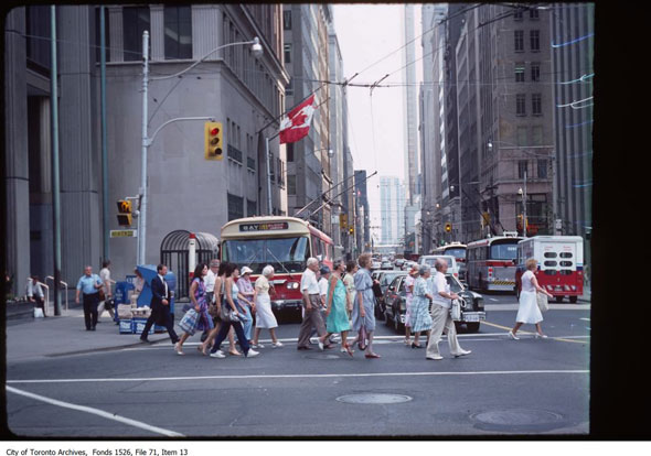
Bay Street trolley buses, July 18, 1983.
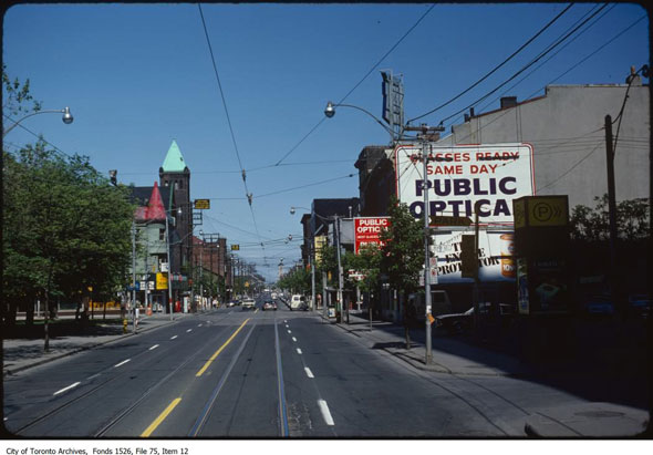
Looking east on Queen across Church, May 31, 1981.
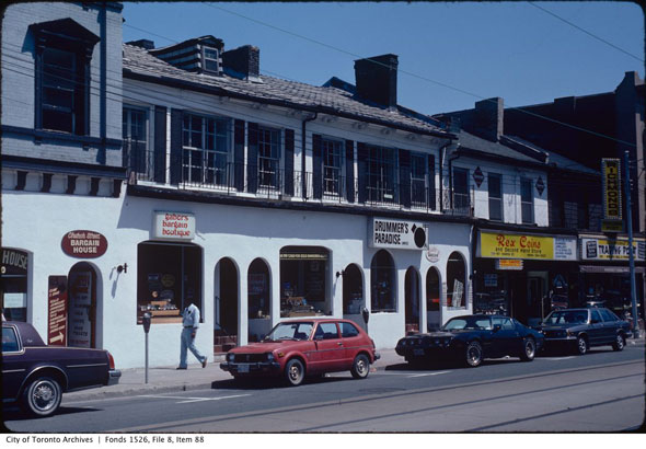
Drummer's Paradise on Church Street at Queen, July 21, 1982.
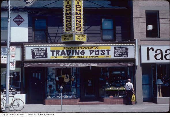
Richmond's Trading Post on Church just north of Queen, July 21, 1982.
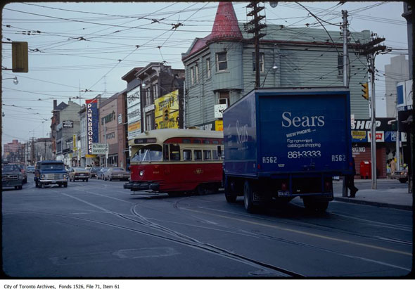
Streetcar turning south onto Church past a Sears delivery van, February 13, 1980.
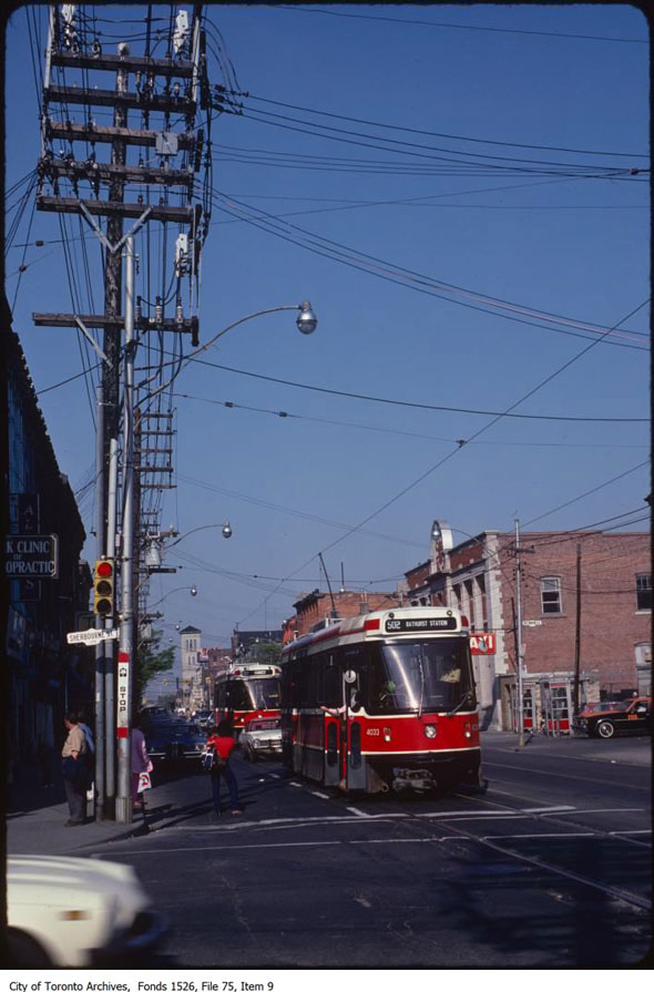
Queen and Sherbourne with St. Paul's Basilica in the background. June 2, 1981.
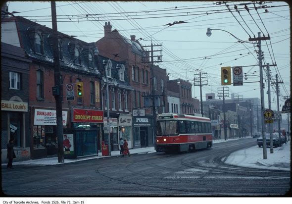
An ice cold Queen and Parliament, looking east, February 6, 1981.
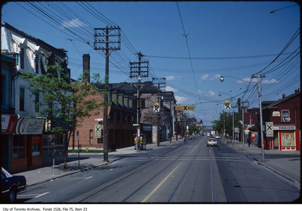
Queen and Sackville, looking east, June 6, 1981.
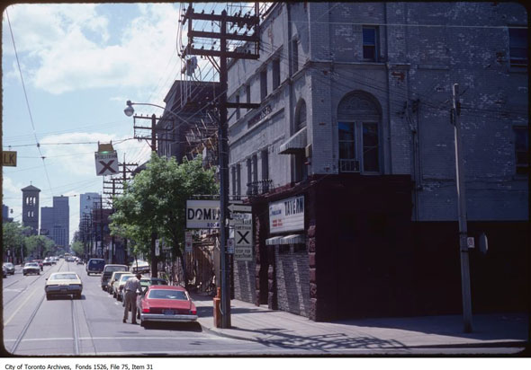
The Dominion on Queen during the bad old days. June 6, 1981.
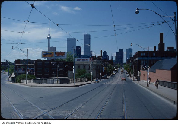
Intersection of Queen and King at the Don River, looking west. No Scotia Plaza, yet. Exchange Tower is under construction behind First Canadian Place. June 2, 1981.
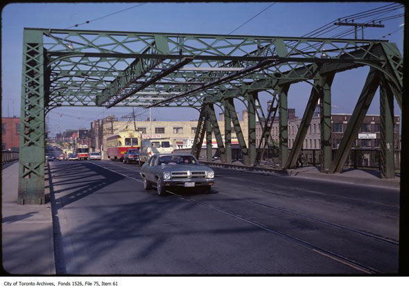
Looking east from the bridge over the Don River, June 2, 1981.
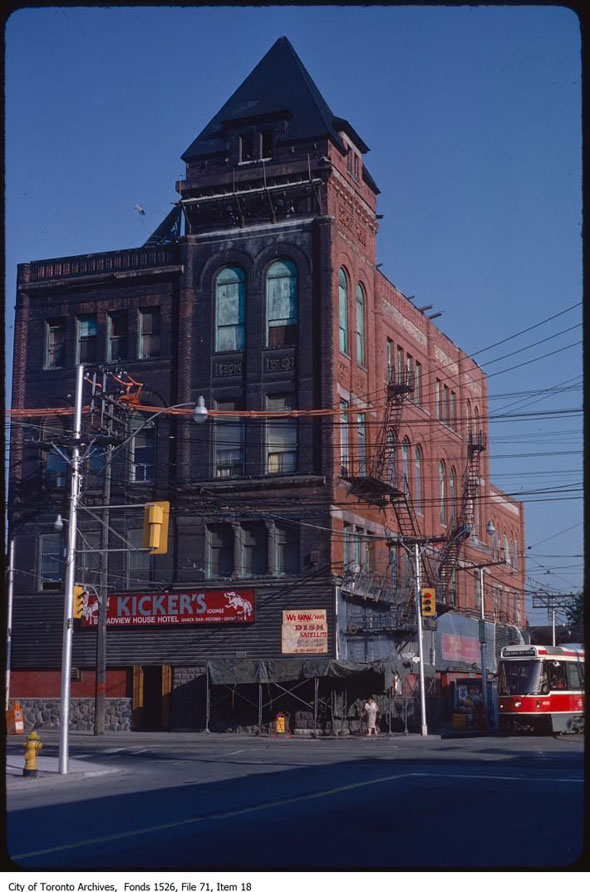
The New Broadview Hotel, a.k.a. Jilly's, as "Kicker's," August 31, 1983.
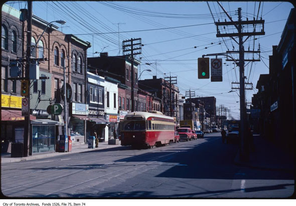
Queen and Broadview, looking east at the stores on the north side of Queen, April 2, 1982.
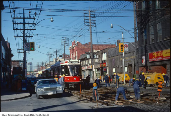
Streetcars continue to operate at Queen and Broadview despite track work (Broadview Hotel is "Maxi's,") March 25, 1981.
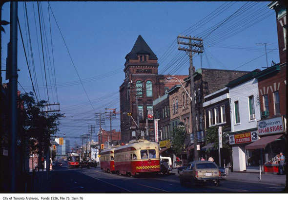
Queen and Broadview, looking west, August 25, 1983.
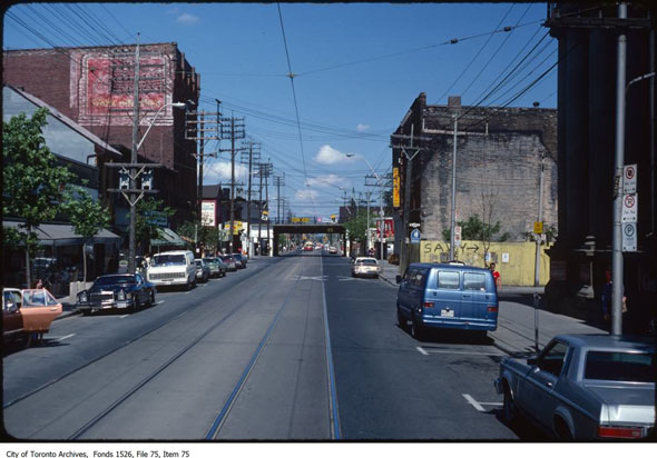
Queen and Saulter, looking toward the rail bridge, June 6, 1981.
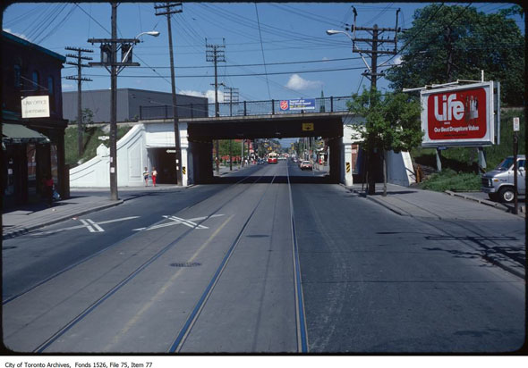
Looking east from Queen and De Grassi under the rail tracks, June 6, 1981.
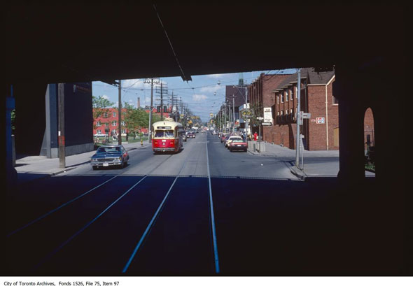
Queen and McGee near the Jimmie Simpson Recreation Centre, June 6, 1981.
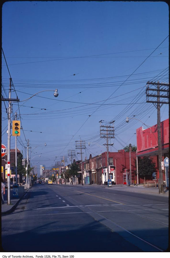
Looking west from Queen and Carlaw in Leslieville, August 31, 1981.
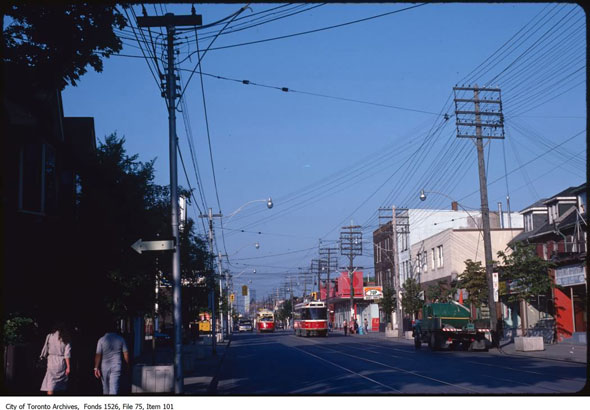
Looking west through Leslieville near Queen and Carlaw, August 31, 1983.
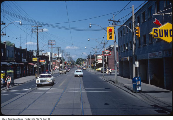
The many gas stations of Queen and Jones, June 6, 1981.
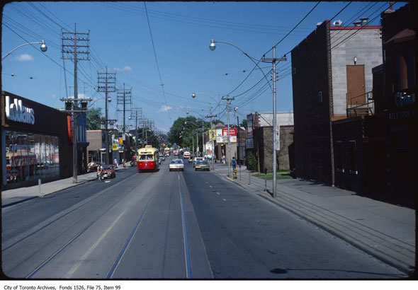
Looking east at Queen and Leslie, June 6, 1981.
Chris Bateman is a staff writer at blogTO. Follow him on Twitter at @chrisbateman.
Images: City of Toronto Archives
Latest Videos
Latest Videos
Join the conversation Load comments


