New Toronto transit map sheds light on commute times across the city
A new interactive transit map of Toronto allows you to see just how far you can move across the city using only public transit.
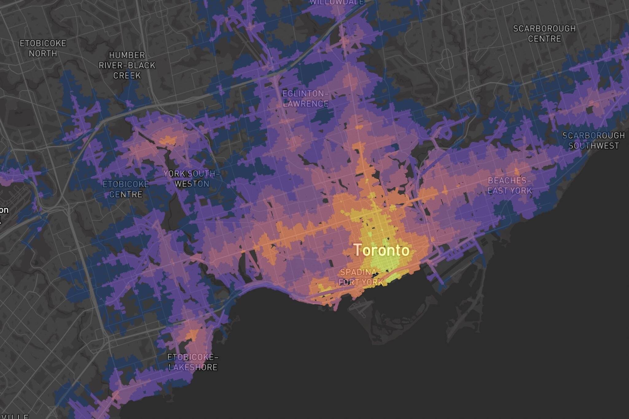
The colour-coded map, called time2reach, sheds light on how transit-accessible parts of the city are when compared to others.
To start, all you have to do is double-click on the map to set your starting origin. Next, you can hover over or click on any other point to view the route you must take to arrive from your previously selected origin.
The interactive map uses a colour-coded scale from yellow — which indicates shorter trip durations — to dark purple, which indicates longer trip durations.
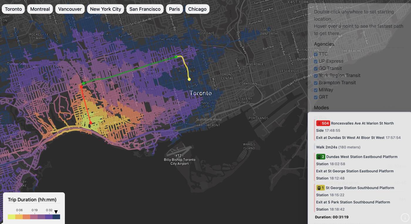
A screenshot of the interactive map. Photo: time2reach.
The tool also takes into account the different transit agencies servicing the GTA, including the TTC, UP Express, GO Transit, York Regional Transit, Brampton Transit, MiWay, as well as Grand River Transit (GRT).
You can select your preferred mode of public transportation from a list that includes the bus, subway, tram, train, and ferry. You can also adjust your starting time and maximum trip duration using the side checklist.
The map currently extends from Scarborough all the way to Clarkson, and even includes some parts of Oakville.
The easy-to-use tool was created by Henry Nguyen, a student at the University of Waterloo.
"I built this while trying to look for housing in Toronto," Nguyen wrote on LinkedIn. "I found myself going back and forth on Google Maps trying to compare which locations have a shorter commute via transit. I completed this project long after I found a place, but hopefully it helps someone else."
Requests for other cities have already started pouring in, with options for Montreal, Vancouver, New York City, San Francisco, Paris, and Chicago already available.
Latest Videos
Latest Videos
Join the conversation Load comments


