Toronto is in for another round of gross winter weather this week
Nobody expects Toronto's weather to be gorgeous in January, but it's hard not to get a little bit excited when meteorologists call for "mild" or "warmer than normal" conditions following a brutal cold snap.
Such predictions can quickly turn painful, however, when said forecast changes and dashes any hopes of going outside for a moderately comfortable winter jog in the near future.
This is exactly what the Weather Network says has happened to predictions for the first week of January on account of "an unforeseen stalling of a stateside warm front" that could have brought "record-setting warmth bathing much of southern Ontario."
"The promise of an exceptionally warm start to the first week of January in Ontario won't pan out as exactly planned," wrote the network in an update on Tuesday, Jan. 3, 2023.
"Not only will it be colder than previously thought, but multiple systems trekking across Central Canada over the next several days will bring numerous shots of messy, winter weather."
A wintry mix to start the first week of January. Multiple systems trekking across the Great Lakes will bring rain and snow to parts of Ontario and Quebec #ONstorm #ONwx #QCstorm https://t.co/pSPjCJJC93
— The Weather Network (@weathernetwork) January 3, 2023
Rainfall warnings remain in effect for most of southwestern Ontario as the work week resumes following a tumultuous holiday season, thanks to a low-pressure system moving into the Great Lakes.
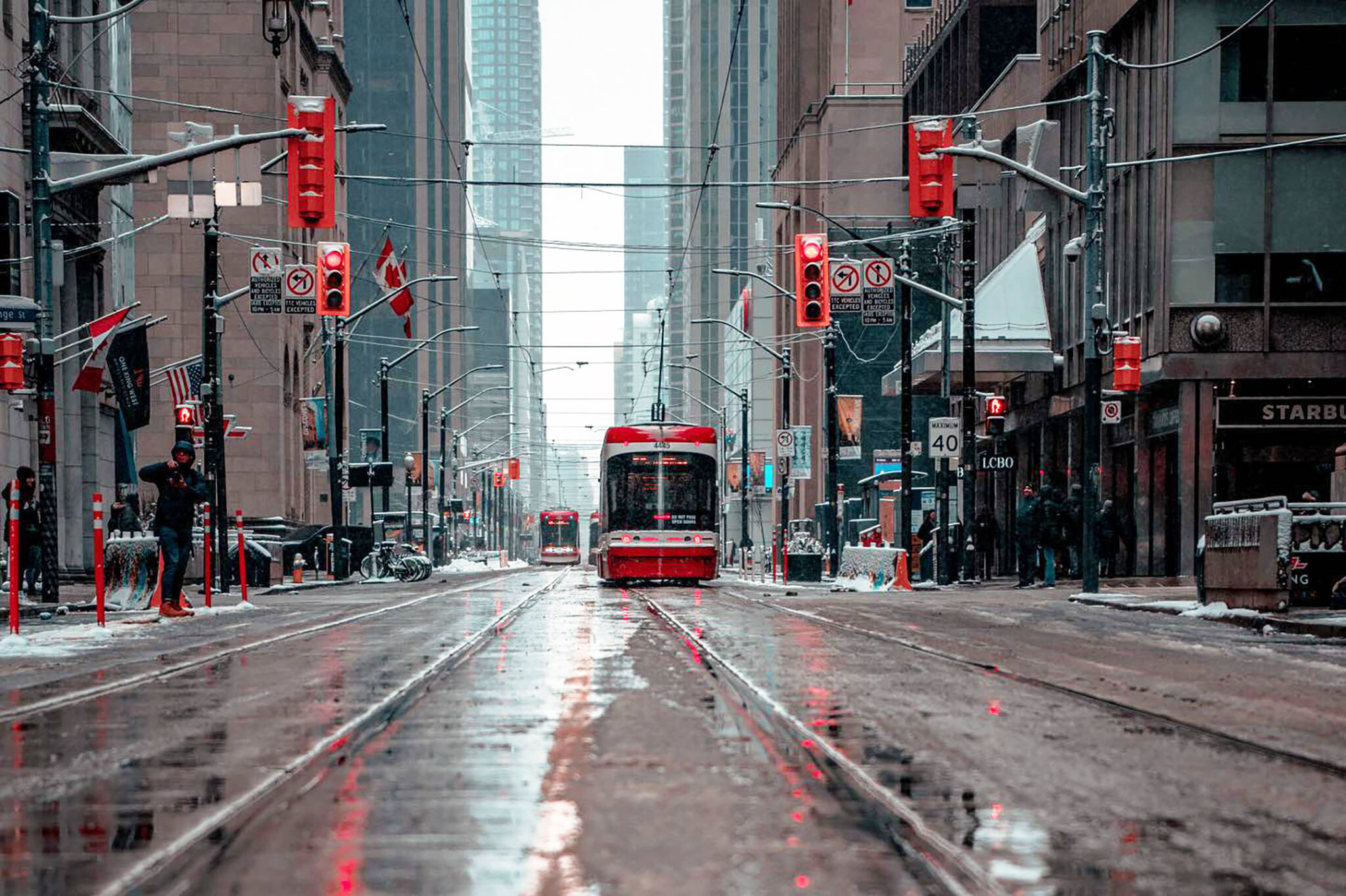
Heavy rains are expected from Windsor through the Niagara Region all day Tuesday, with thunder and lightning possible. In the City of Toronto, where no Environment Canada warnings are currently active, we can simply expect a string of wet, grey and chilly days.
"A difference of just a hundred kilometres in the location of this stalling front meant the difference between unusual January warmth and a chilly, dreary day," notes The Weather Network.
"Since the front will come to a halt, the day's warmest temperatures will remain confined to far southwestern Ontario, where areas southeast of Windsor sitting just the double-digits at 9°C. North of the warm front, temperatures will remain in the low single digits."
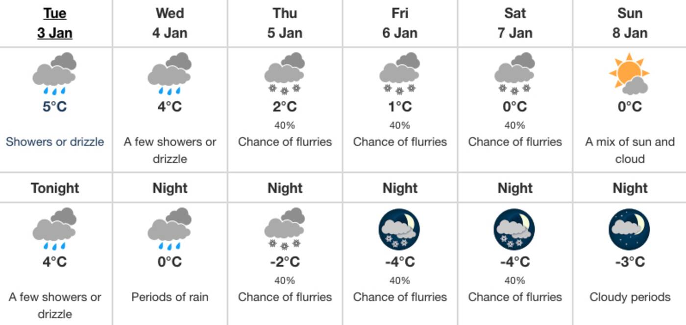
It's going to be cool, grey and rainy in Toronto for the rest of the first week of January. Image via Environment Canada.
An EnviroCan warning for Hamilton states that another round of widespread rain should develop across the region on Wednesday afternoon, and the forecast for Toronto suggests that we'll be hit, too.
The warmest temperatures are expected to get in Canada's largest city this week are 4 C on Wednesday amid showers and drizzle before changing into snow and going down into the negatives again on Thursday night.
Not a speck of sunshine is in Environment Canada's Toronto forecast until at least Sunday, Jan. 8.
As for today, Tuesday afternoon showers are predicted to make way for "fog patches" developing on Tuesday evening, so plan ahead if you're travelling and stay safe on the roads.
Latest Videos
Latest Videos
Join the conversation Load comments


