Toronto's waterfront wasteland underwent a stunning transformation in 2021
Once an inhospitable industrial wasteland, Toronto's Port Lands area is undergoing a rapid transformation that will make this formerly barren stretch of waterfront land a pretty inviting place to live, work, and play in just a few years.
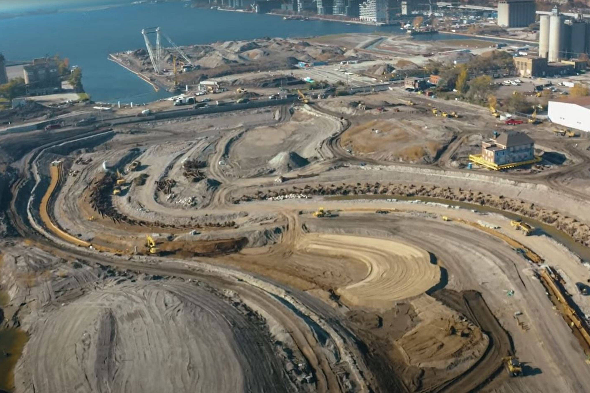
Between the Cherry Street Lakefilling Project starting to form the new Villiers Island and Lake Shore Boulevard East/Gardiner Project erasing a stretch of the elevated expressway and a major barrier to the area, 2021 was a big year for this pocket of the city.
Waterfront Toronto released a video towards the end of the year updating the public on all of the progress recorded in 2021, and it's quite a shock to see just how far the area has come.
The video talks viewers through the various changes unfolding in the area, most notably the new naturalized mouth of the Don River being carved, forming the future Villiers Island.
It's a substantial excavation, with 911K cubic metres of soil removed to date, and crews have been discovering interesting historic artifacts along the way.
But there's so much more that's happened beyond the walls of this excavation in 2021, like a 1920s fire hall being lifted off its foundations and relocated, the arrival of striking new bridges forming key links in an enhanced road network, and even new life returning to fish habitats carved out of former industrial land.
The scale of the work is tricky to put into perspective, and a rare firsthand look at the inner workings of the project offered a window into the magnitude of carving out a new river valley and laying the necessary infrastructure to support the new island and parklands that will define this area in 2024.
The Gardiner Expressway was also a hot topic in 2021, its easternmost section torn down as part of a plan to rehabilitate Lake Shore Boulevard East and reroute Gardiner traffic.
blogTO was on the scene to document the Gardiner East removal in mid-2021, capturing once-in-a-generation images of a highway being reduced to dust.
But there are still two years left before the area's transformation is complete, and that is really only the conclusion of the first chapter.
Once the roads are laid, the river is flowing around the new island, and the parks open to the public, an area roughly equivalent in size to Toronto's downtown core will be unlocked for future development opportunities.
Waterfront Toronto
Latest Videos
Latest Videos
Join the conversation Load comments


