New map charts parks near TTC stations
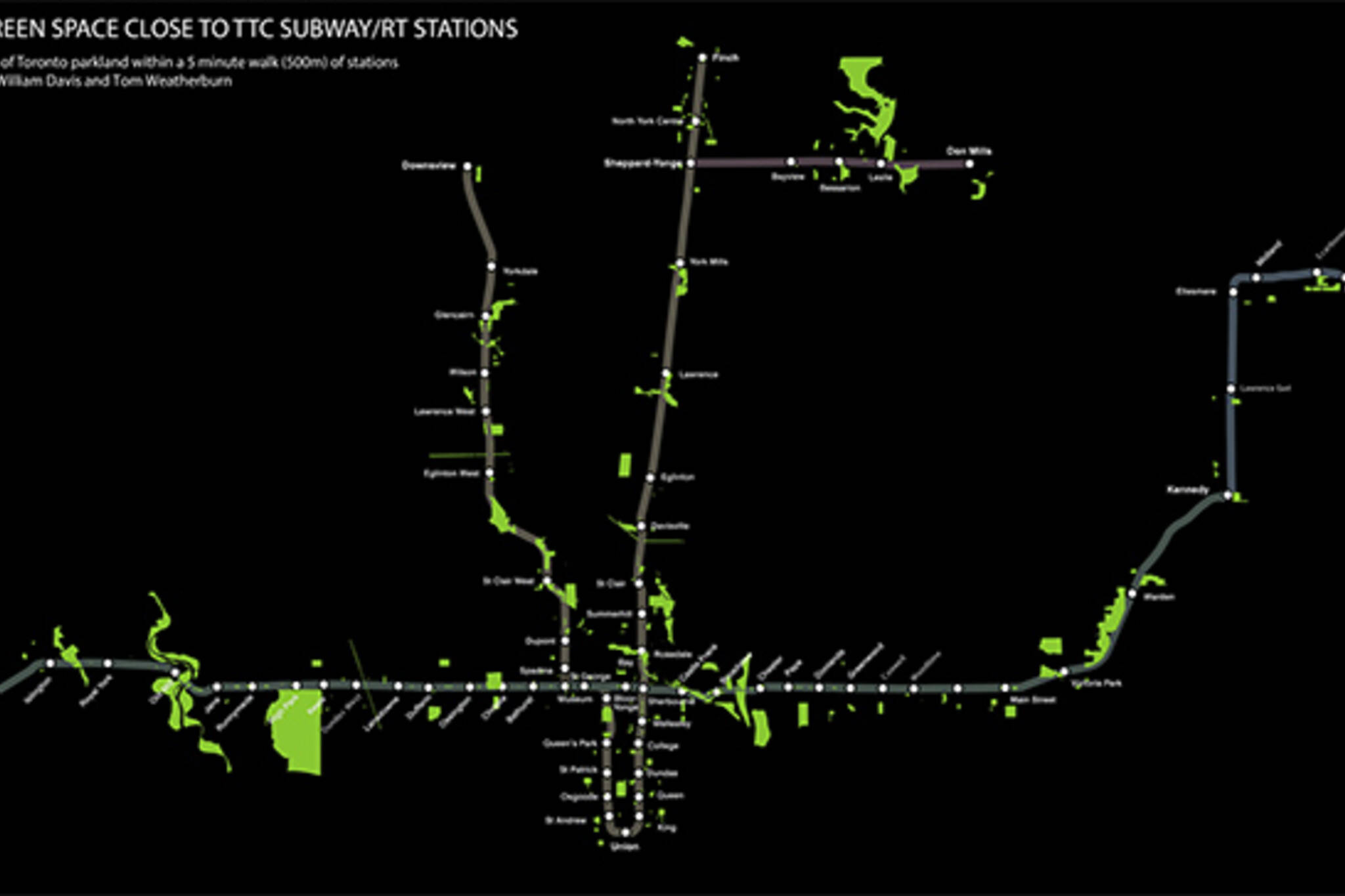
The TTC map has been used to track such divergent things as bars, apartment rental prices, and the time it takes to walk or ride a bike between stations, but this latest mash-up might be one of the most useful. William Davis and Tom Weatherburn have plotted out parks that are located within a five minute walk of each subway stop.
Almost all of our 69 stops feature a decent size green space within about 500 metres of their entrance. Wilson is one of the only exceptions to the rule, located as it is in the midst of a sea of commuter parking lots. On the other end of the spectrum is Old Mill Station, which is surrounded by lush parkland.
Car-less residents of this city might use this map to plan their next picnic, but even in the absence of use value, it provides an intriguing look at our urban environment. It might be surprising, for instance, to note how little parkland there is in close proximity to Bathurst Station. This is a function of the 500 metre radius, of course, but still defies expectations.
Take a look at a high resolution version of the map here.
Latest Videos
Latest Videos
Join the conversation Load comments


