Colourful new map charts Toronto buildings by height
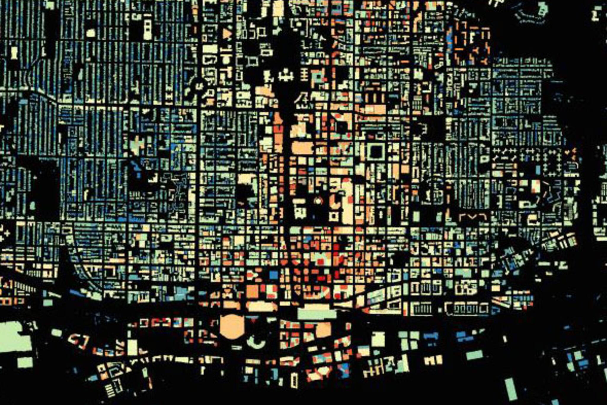
Toronto looks like something out of Tron if you colour each building based on its height, like map maker and open data enthusiast Pat Forestell did this weekend.
Forestell, who also made the map of Toronto travel patterns, says he decided to put the map together on a whim Sunday morning. The bulk of the work took about an hour using information pulled from the City of Toronto's Open Data portal. The rest was mostly colouring, he says.
"I like how you can see the differences in urban form as you go further north. That's my favourite thing about this, the street design in Old Toronto vs. Scarborough, North York, and Etobicoke," he says.
Landmarks worth exploring on the full size version of the map include the Bridle Path neighbourhood, which stands out among its neighbours thanks to its extremely large property sizes. Highways, ravines, and railway lands appear as strips of darkness while the downtown core is a brightly coloured mix of mid- to high-rise buildings.
The map also illustrates the north-south strip between University Ave. and Yonge St. where most of the city's tallest buildings are clustered. See what you can find.
Follow Chris Bateman on Twitter at @chrisbateman.
Image: Pat Forestell
Latest Videos
Latest Videos
Join the conversation Load comments


