Where does Toronto get its weather forecast from?
Open any weather app on your smartphone and chances are there will be a prediction about rain, snow, sleet, or hail. How much is coming, where it will fall, and in some cases whether or not there is some form of precipitation falling where you are, right now.
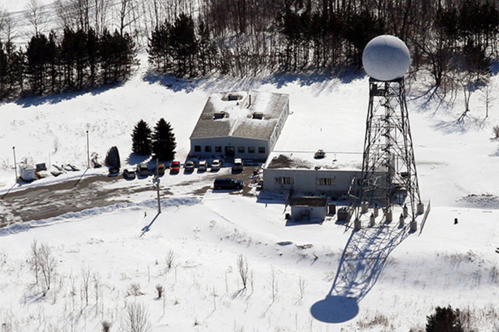
It might seem obvious (how hard can it be to tell whether it's raining or not, right,) but without an important piece of equipment in King City, Ontario, we would be largely in the dark about liquid falling from the sky in Toronto.
The $2 million King City Radar Station was completed in 1984 by Environment Canada. The federal department spent 14 months searching for a suitable elevated site on the Oak Ridges moraine that could replace a station in Woodbridge that was approaching the end of its working life.
At 27 metres tall and more than 310 metres above sea level, the King City station is ideally placed to watch over a 240 kilometres radius that includes Goderich, Kingston, North Bay, even areas as far south Erie, Pennsylvania.
"It's one of approximately 30 across the country which detect precipitation via microwaves and produce an image we can use to inspect ourselves or show the public as to where the precipitation is falling," says Peter Kimbell, a Warning Preparedness Meteorologist with Environment Canada.
Put simply, the towers send out pulses of microwaves and then measures what's reflected back, and how strongly (rain reflects better than snow, for example.) The information is then processed into the kind graphical representation Environment Canada makes available online.
Kimbell says the towers use a mix of conventional and Doppler radar to detect the location and speed of rain drops, snow flakes, hail stones--anything moving through the air, including flocks of birds and tornadoes. Wind shear, a sudden change of wind direction over a small area that's potentially hazardous to aircraft, also shows up on the readouts.
King City is an important piece of equipment, but it takes more than just radar images to produce a weather forecast, he says. Data from satellites, aircraft, and land-based weather stations that measure humidity, atmospheric pressure, and other conditions are fed into complex computer models used by meteorologists, too.
"Radar is only one piece of a large puzzle," says Kimbell. "It tells us where precipitation is occurring, it's not telling us what's happening an hour or two hours from now."
Next time your phone tells you it's snowing or raining, you know what to thank.
Chris Bateman is a staff writer at blogTO. Follow him on Twitter at @chrisbateman.
Photo by i. duke on Flickr
Latest Videos
Latest Videos
Join the conversation Load comments


