Toronto prior to the 1850s
As I promised last week, instead of ending this series with the first photographs of Toronto, today's post gathers together a number of lithographs, maps, paintings and other documents to illustrate what Toronto was like prior to the 1850s. The materials below are certainly something of a hodgepodge, selected based on availability more than anything else. Nevertheless, they are fascinating, particularly when placed within the context of the series as a whole. A comparison of the depictions of Toronto in the 1840s to the photographs from the 1900s, for instance, is as startling as it is intriguing. In just over 50 years, the then recently incorporated but still undeveloped city sprouted into a thriving metropolis, one which bore little resemblance to its former self.
There is, of course, little left of the city that one sees in the images below, save for a few key landmarks and the general geographical make-up of the site upon which Toronto currently stands. One of the more obvious and visible exceptions, of course, is Fort York, the buildings of which technically date back to 1813 when they were rebuilt following the war (though the site was founded in 1793). Other notable pre-1850s structures in Toronto include Scadding Cabin (1794, but moved from its original location), the Gibraltar Point Lighthouse (1808), the Grange (1817), Campbell House (1822), the Bank of Upper Canada Building (1827), Osgoode Hall (1832), Toronto's First Post Office (1833), and a host of churches built in the 1840s (full list here).
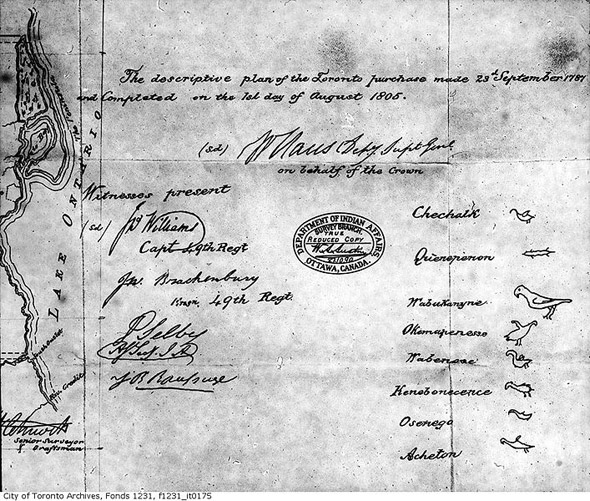
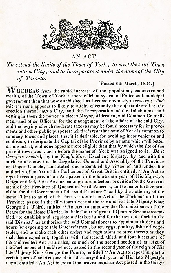
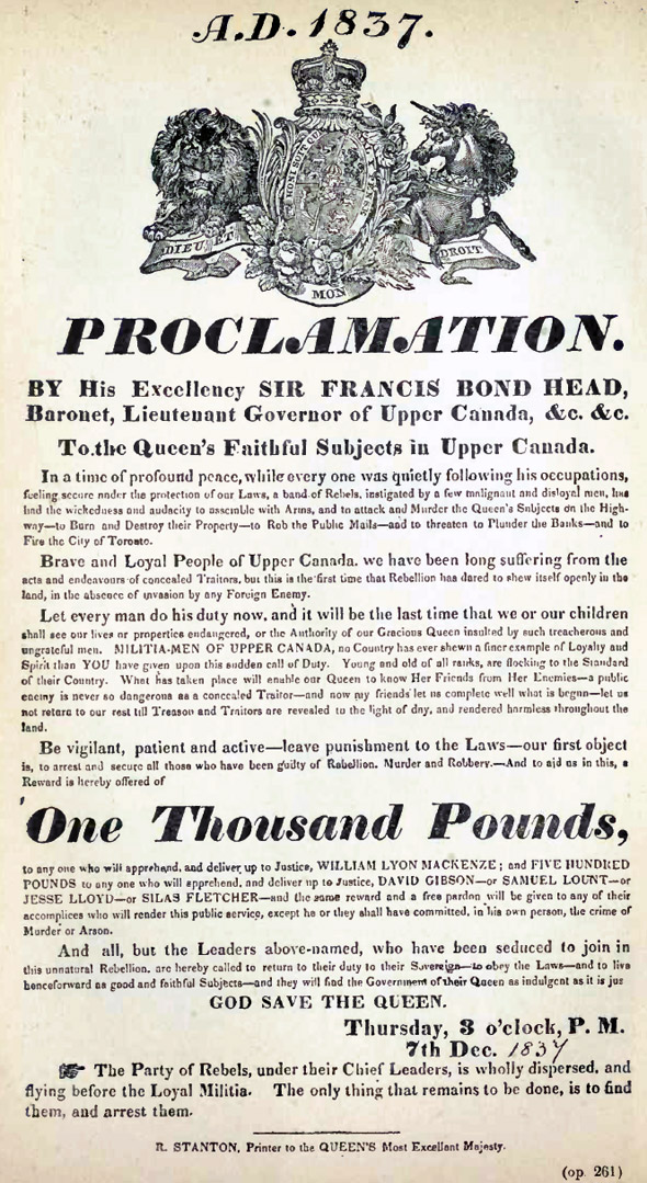
I won't mention everything collected below, but some of the highlights for me include the map of the Toronto purchase from 1787, the map of the city's rivers from 1797, the 1834 Act Incorporating Toronto, and the 1837 Proclamation for the Arrest of William Lyon Mackenzie.
In lieu of the written description and context that these materials deserve, I've attempted to hyperlink where specific information on an image or document is available, but Carl Benn's The History of Toronto: An 11,000 Year Journey, is an excellent - and freely available - general resource that's been most helpful in putting this and the other posts in the series together. I highly recommend having a pass through its pages. Also interesting, considering the prevalence with which Fort York appears below and its importance to the development of Toronto, is the Friends of Fort York website, which has a variety of free resources on the Fort and its history.
Map of the
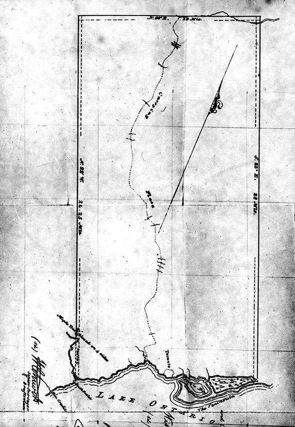
Ratification of the Toronto Purchase 1805
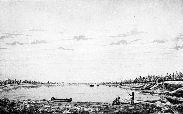
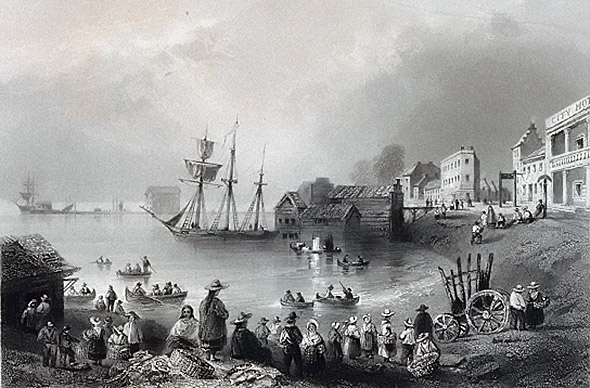
Toronto Harbour in 1793 (
The Rivers of Toronto 1797 (see
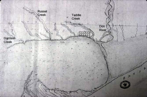
Lost Rivers for more information)
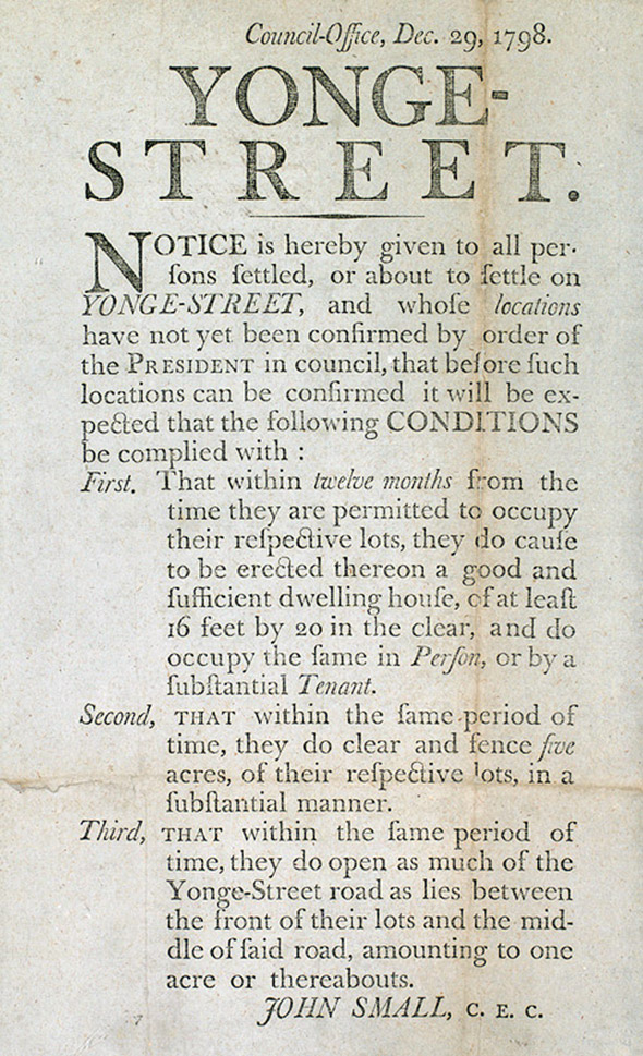
Notice to settlers on Yonge Street 1798
York 1803
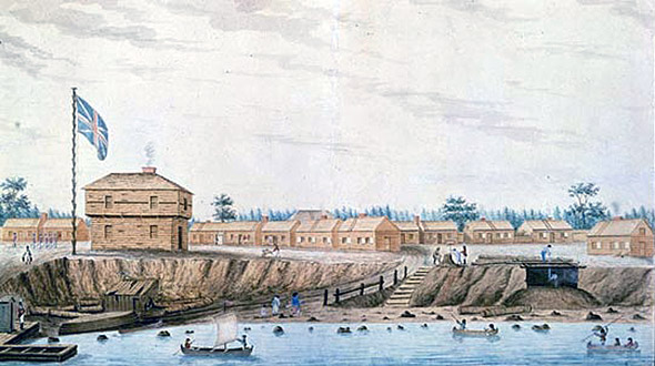
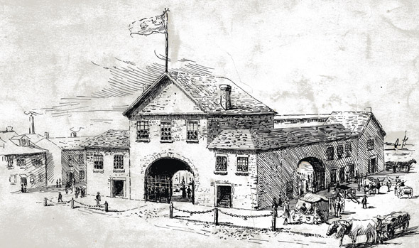
Fort York 1804
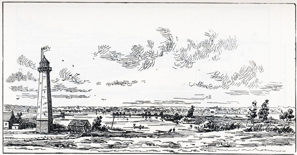
Ca. 1808
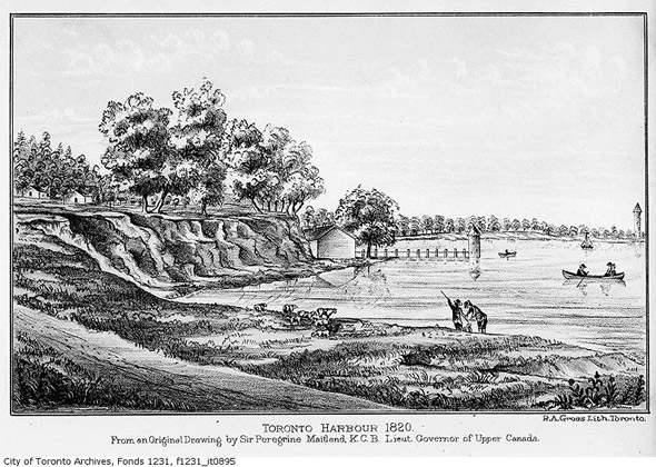
Toronto Harbour 1820s
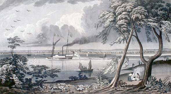
From Gibraltar Point 1820s
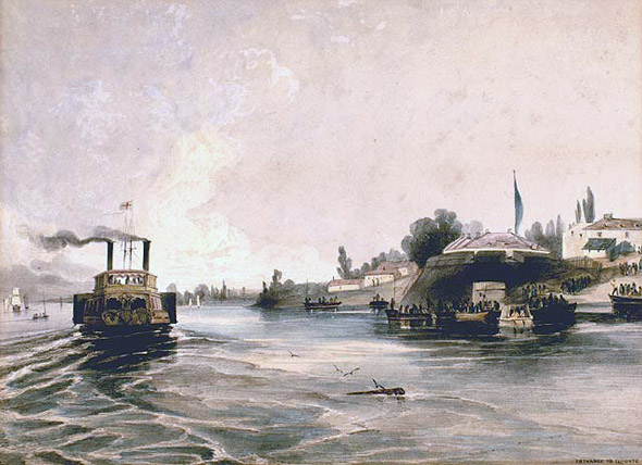
Entrance to Toronto Harbour
The Second Market in Toronto 1831
Toronto Fish Market 1830s
1834 Act Incorporating the City of Toronto
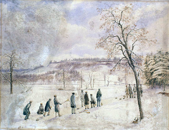
Curling in High Park Ca. 1830s
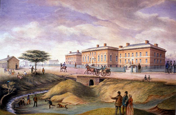
Third Parliament Buildings 1834
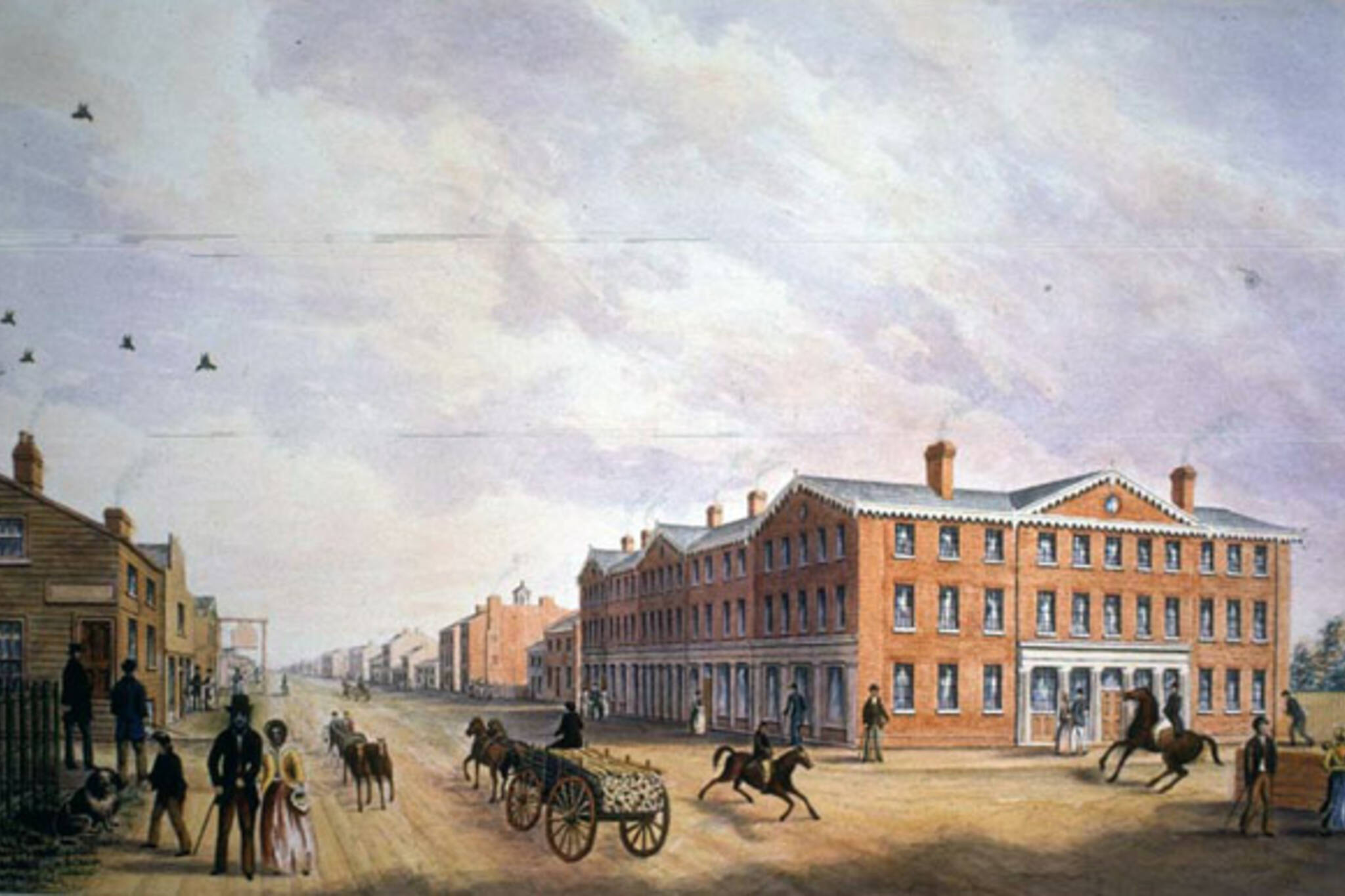
King Street Looking eastward
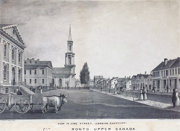
North side of King Street from Toronto to Church streets 1835
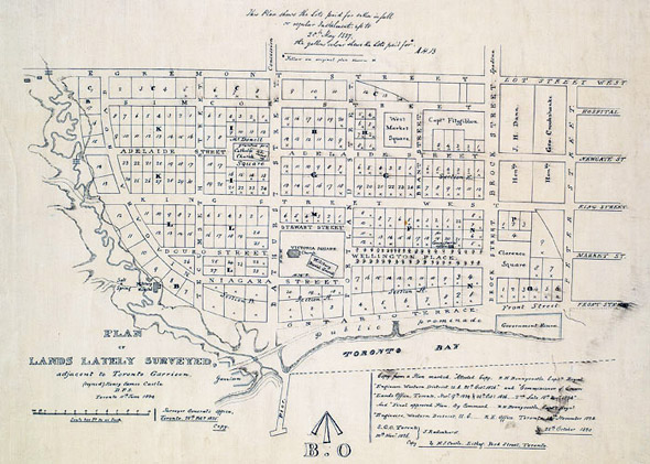
Toronto Extension Plan
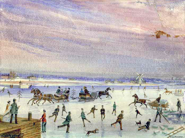
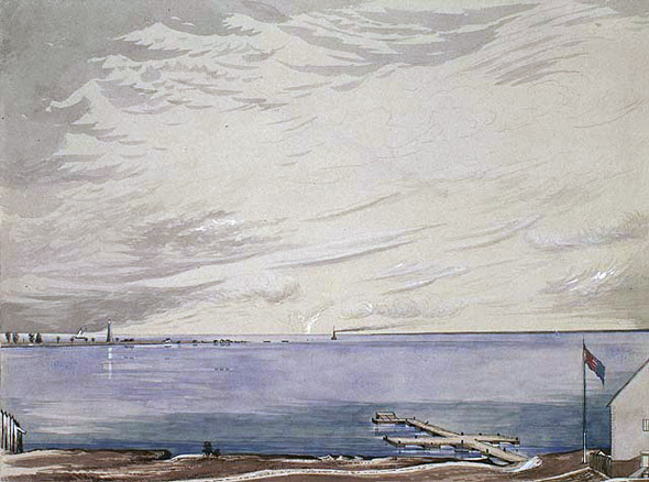
Winter Scene on Toronto Bay Ca. 1830s
Proclamation for the Arrest of William Lyon Mackenzie 1837
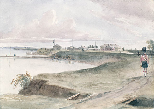
Fort and Pier 1839
(current site of the Gooderham/Flat Iron building)
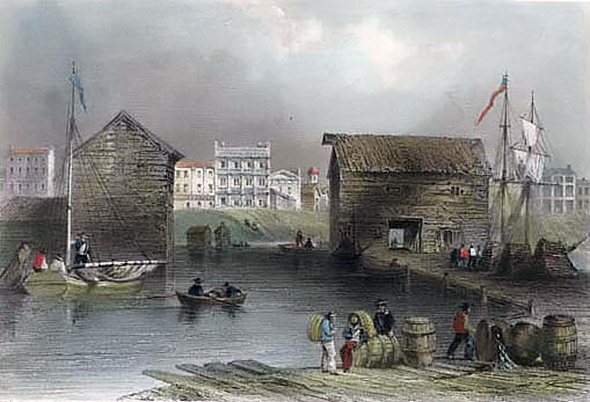
Wharf at the New Barracks Ca. 1840s
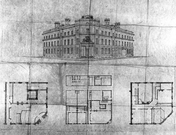
Plans for the
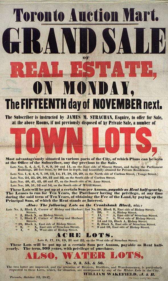
Real Estate poster 1847
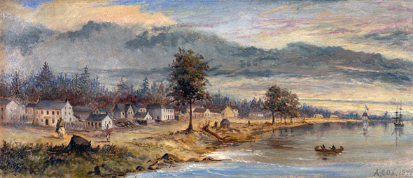
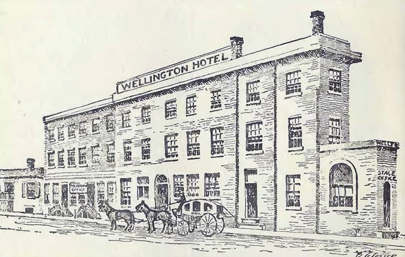
Toronto Ca. 1840s
See the rest of the series here:
- Toronto of the 1990s
- Toronto of the 1980s
- Toronto of the 1970s
- Toronto of the 1960s
- Toronto of the 1950s
- Toronto of the 1940s
- Toronto of the 1930s
- Toronto of the 1920s
- Toronto of the 1910s
- Toronto of the 1900s
- Toronto of the 1890s
- Toronto of the 1880s
- Toronto of the 1870s
- Toronto of the 1860s
- Toronto of the 1850s
Although this draws the series to a close as far as new material goes, I suspect that based on its popularity it might make sense to cap it off with a sort of "best of" post, which collects some of the best images from each decade into overview of the city's development. If that's something that'd be of interest, please let me know.
Images from the Toronto Archives, Toronto Public Library, Ontario Archives and the Wikimedia Commons
Latest Videos
Latest Videos
Join the conversation Load comments


