Here's what the TTC and surrounding regional transit map could look like in 2070
A sprawling fantasy map offers a glimpse into what the Greater Toronto Area (GTA) transit network could look like decades in the future.
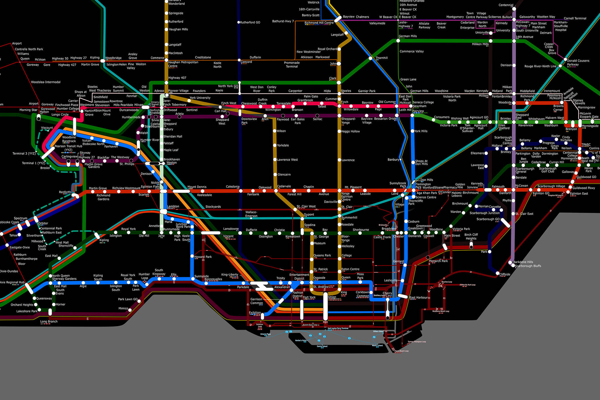
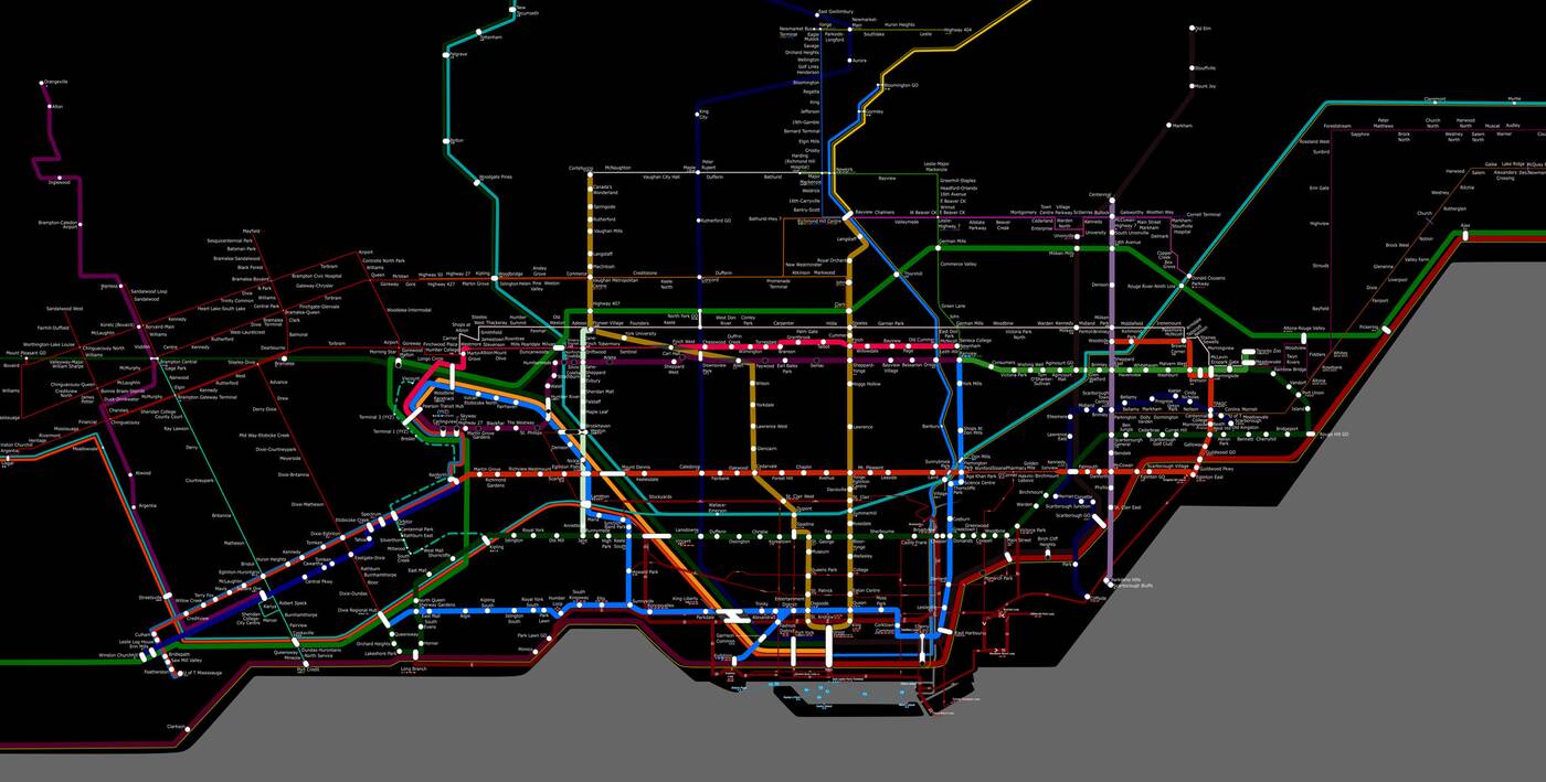
Transit enthusiast Jamie Kauri has published an impressive vision of the future showing a much-more-fleshed-out TTC network connected to a massive regional transit system stretching from Peterborough in the east to Kitchener and London in the west, and from Lake Simcoe in the north to Hamilton in the south.
After a year of design, I've finally completed my fantasy transit map of the Greater Toronto Area!
— Jamie (she/they) (@TransitThinker) April 18, 2023
I tried to keep things realistic (but, yes there are some silly things!) Let me know what you think pic.twitter.com/W6gkWfvoSW
Kauri tells blogTO she has put over 200 hours of work into the project, dedicating roughly five hours per week since early 2022, and creating the detailed map using Inkscape, a free software similar to Adobe Illustrator.
The resulting diagram combines planned and under-construction transit lines, including theoretical extensions and entirely new routes to serve the rapidly-growing region.
Current projects like the Eglinton Crosstown, Finch West LRT, and Ontario Line are all represented among confirmed and hypothetical additions to these routes, notably some interesting spurs extending the Ontario Line's planned route to the north and west.
In addition to existing and planned subway routes in Toronto, the map contemplates a new Line 7 Sheppard East route, additional routes serving Scarborough in the Line 8 Scarborough and Line 10 McCowan routes, a Line 11 serving Steeles Avenue, and a Line 12 running through Etobicoke.
Kauri notes that, while the map is mostly a realistic vision of things to come, some admittedly "silly" creative liberties were taken along the way.
"I decided to convert the Scarborough Subway Extension into an Ontario Line technology and extend line 2 along Lawrence East instead," says Kauri.
"Also, Line 5, going from the edge of Mississauga to Scarborough, is a bit wild."
But the funniest Easter egg is a blink-and-you'll-miss-it gag in the map's far-western reaches, with Kauri explaining, "I just had to call London 'Fake London.'"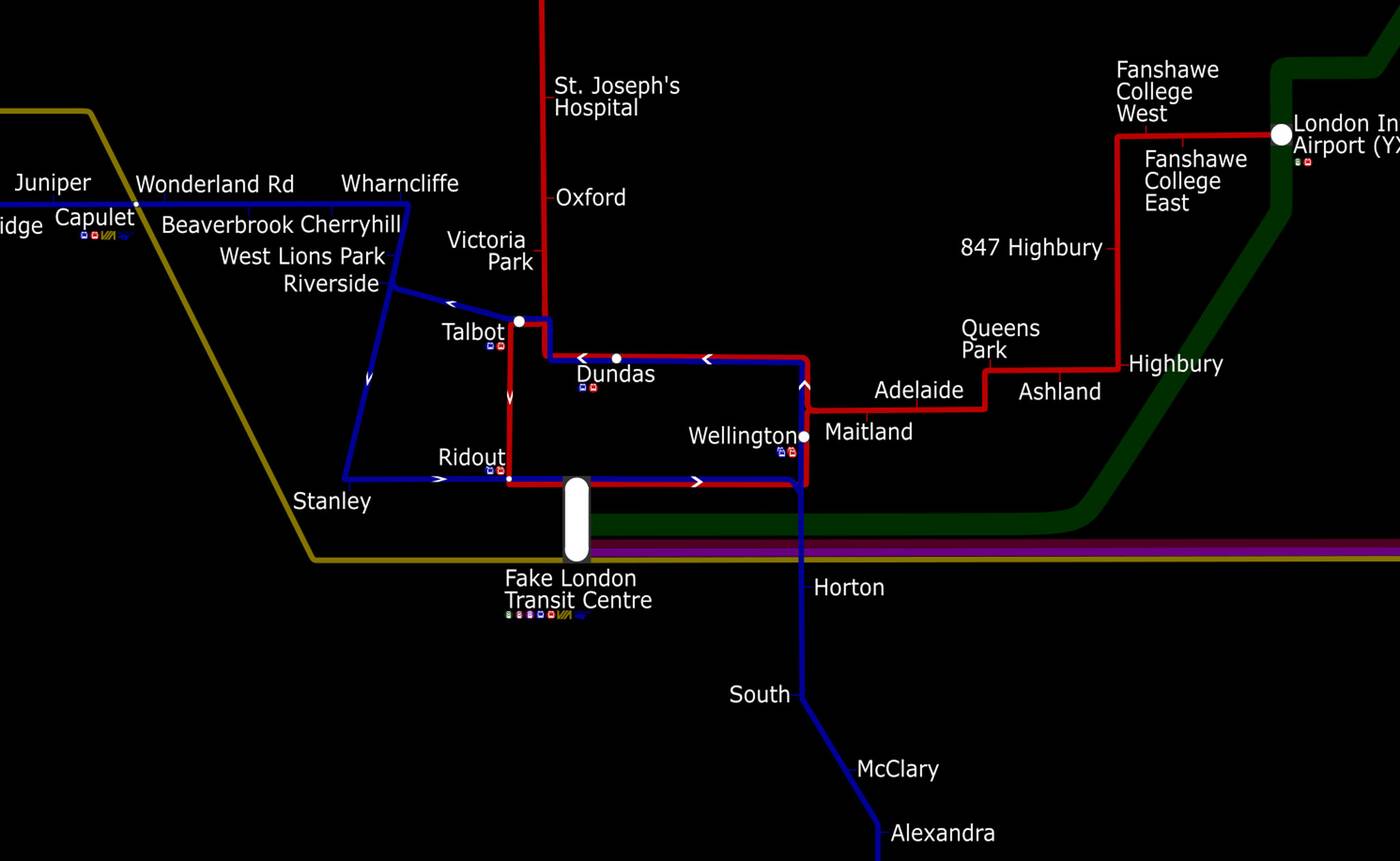
"If I had to choose a year, I'd say it could probably be completed by 2070, which could give enough time to space out the projects and budget."
There is so much more to explore on this map, with a download available offering over 19,000 pixels of width to painstakingly examine for an idea of how your commute might improve in future decades.
Latest Videos
Latest Videos
Join the conversation Load comments


